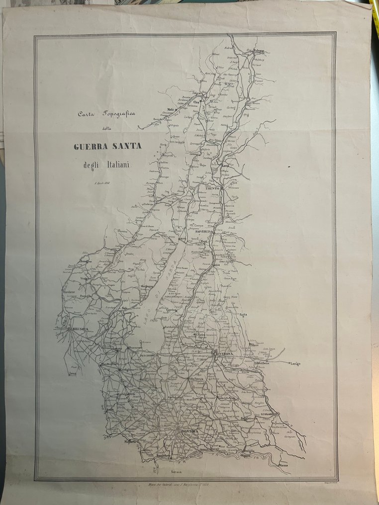
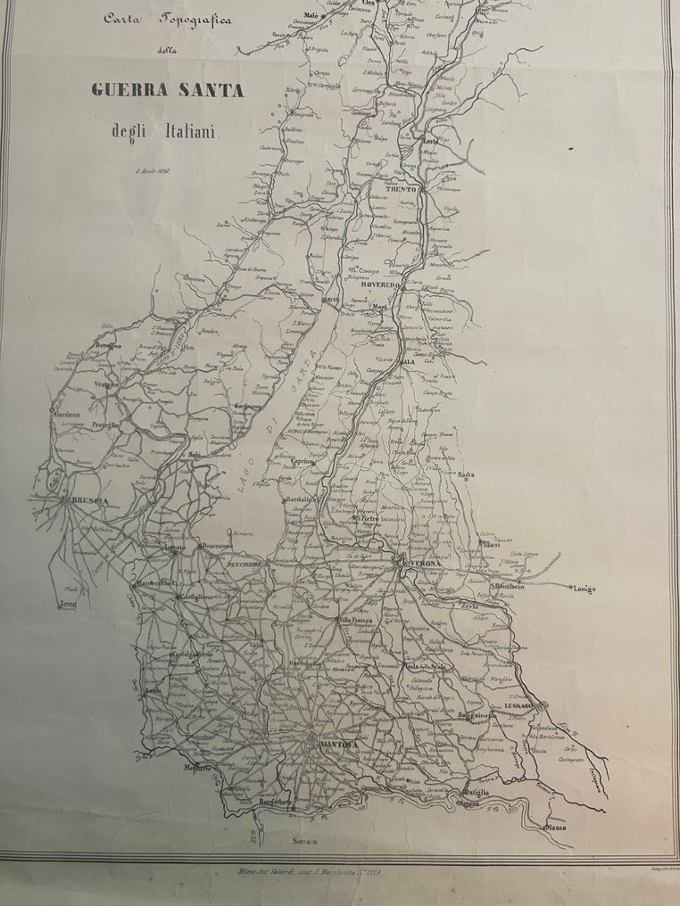
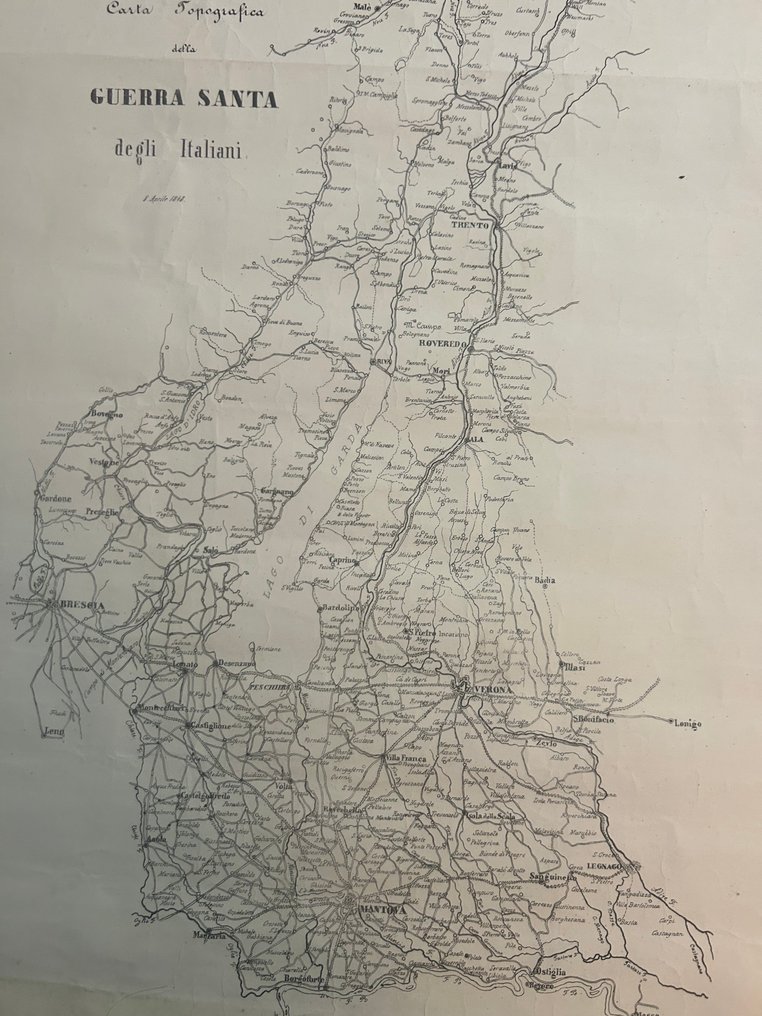
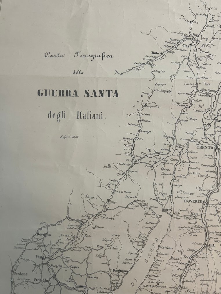
Italy - Brescia / Lake d’Idro / Lake Garda / Riva / Rovereto / Trento / Verona / Peschiera / Desenzano; Antonio Vallardi, Milano (“Milano Ant. Vallardi, contr. S. Margherita N. 1118”) - Carta Topografica della Guerra Santa degli Italiani” - 1821-1850

00
days
16
hours
55
minutes
04
seconds
Current bid
€ 70
No reserve price
Ilaria Colombo
Expert
Selected by Ilaria Colombo

Specialist in old books, specialising in theological disputes since 1999.

Estimate  € 140 - € 210
24 other people are watching this object
itBidder 1898 €70
itBidder 2861 €65
frBidder 7297 €60

Catawiki Buyer Protection

Your payment’s safe with us until you receive your object.View details

Trustpilot 4.4 | 121798 reviews

Rated Excellent on Trustpilot.

Carta Topografica della Guerra Santa degli Italiani by Antonio Vallardi, Milano, an uncoloured copperplate map of Italia showing the 1848 theatre of operations between Brescia, Lago d’Idro, Lago di Garda, Riva, Rovereto, Trento, Verona, Mantova, Legnago, Lonato, Desenzano, Peschiera, Castiglione, Valeggio and Borgoforte in a good condition, sized 550 × 380 mm.

AI-assisted summary

Description from the seller

The map depicts in detail the theater of military operations in 1848, during the first major conflict between the Kingdom of Sardinia and the Austrian Empire. The area depicted includes the entire strategic axis between:

Brescia / Lake Idro / Lake Garda / Riva / Rovereto / Trento / Verona / Mantua / Legnago / Lonato / Desenzano / Peschiera / Castiglione / Valeggio / Borgoforte

It is a military topographic map showing:
• main and secondary roads
• rivers, canals and tactical passages
• towns, fortresses and strongholds
• connection lines between Lombardy, Veneto and Trentino
• the position of the Alpine and pre-Alpine lakes, fundamental for war logistics

The highlighted area is the one that, between March and August 1848, was the heart of the Italian Holy War, as the patriotic press of the time called it.
Condition

Good for the time.
Editorial centerfold, light creasing at the edges, some signs of wear on the back, but overall the paper is solid and legible. No missing parts.

Details

Era
1400-1900
Number of items
1
Country
Italy
Geographical specification
Brescia / Lake d’Idro / Lake Garda / Riva / Rovereto / Trento / Verona / Peschiera / Desenzano
Map maker/ publisher
Antonio Vallardi, Milano (“Milano Ant. Vallardi, contr. S. Margherita N. 1118”)
Map/ Book title
Carta Topografica della Guerra Santa degli Italiani”
Period
1821-1850
Condition
Good
Technique
Etching
Additional Information
1848 Risorgimento military maps.
Map colour
Uncoloured map
Height
550 mm
Width
380 mm
Sold by
ItalyVerified
3189
Objects sold
100%
protop

Similar objects

For you in

Maps