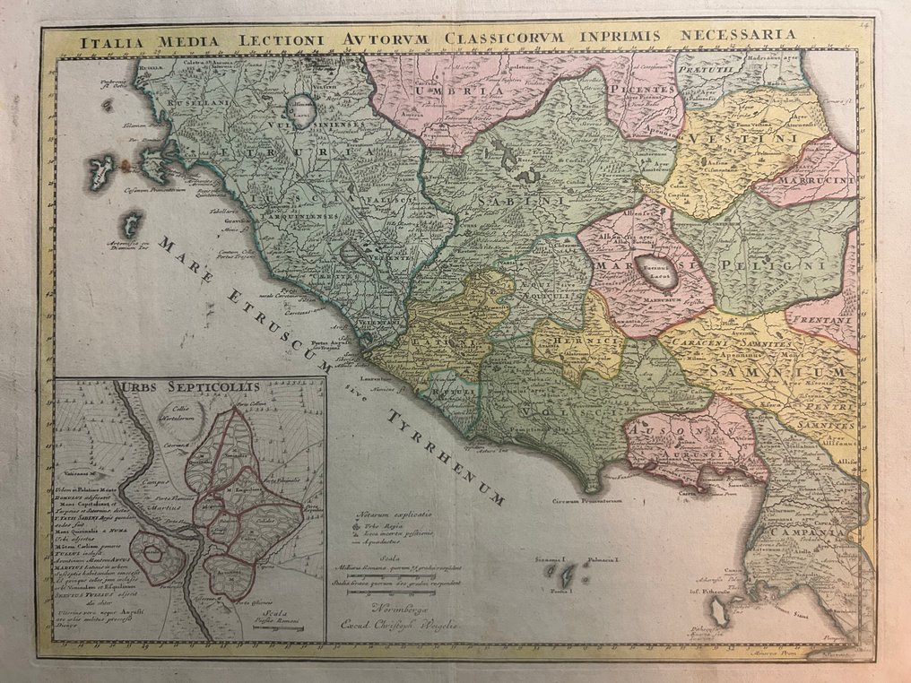
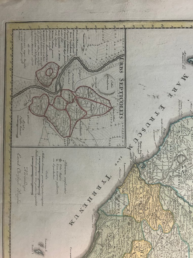
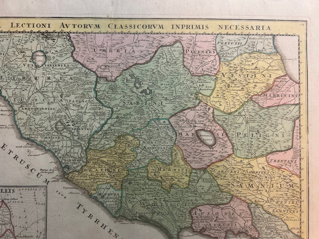
Italy - Tuscany / Lazio / Umbria / Abruzzo / Campania / Ischia / Procida / Nisida; Johann Christoph (Christophorus) Weigel - Italia Media – Lectioni Auctorum Classicorum Inprimis Necessaria - 1701-1720

00
days
16
hours
40
minutes
32
seconds
Current bid
€ 10
No reserve price
Ilaria Colombo
Expert
Selected by Ilaria Colombo

Specialist in old books, specialising in theological disputes since 1999.

Estimate  € 150 - € 180
18 other people are watching this object
itBidder 6744 €10
beBidder 8931 €10
itBidder 6744 €9

Catawiki Buyer Protection

Your payment’s safe with us until you receive your object.View details

Trustpilot 4.4 | 121798 reviews

Rated Excellent on Trustpilot.

Italia Media – Lectioni Auctorum Classicorum Inprimis Necessaria, by Johann Christoph (Christophorus) Weigel of Nuremberg, is a hand-coloured copper-engraved map of central and Tyrrhenian Italy in Roman times with regions such as Etruria, Umbria, Sabina, Latium, Campania and Samnium, including an inset plan of Urbs Septicollis; size 330 × 420 mm, in good condition for its age with minor staining and natural oxidation, and a clean verso.

AI-assisted summary

Description from the seller

Beautiful and rare map of central and Tyrrhenian Italy in the Roman era, made by J.C. Weigel in Nuremberg.
The map shows the historical regions of ancient Italy – Etruria, Umbria, Sabina, Latium, Campania, Samnium – with hand-colored borders and hatched mountains.

In the top left box there is an ancient map of the Rome of the seven hills (“Urbs Septicollis”), with the hills highlighted in red and the Tiber.
The map is very rich in Latin toponyms, roads, ancient routes and archaeological sites.

Status:
Excellent condition for its age; some light wear and small natural oxidation. Clean back.

Details

Era
1400-1900
Number of items
1
Country
Italy
Geographical specification
Tuscany / Lazio / Umbria / Abruzzo / Campania / Ischia / Procida / Nisida
Map maker/ publisher
Johann Christoph (Christophorus) Weigel
Map/ Book title
Italia Media – Lectioni Auctorum Classicorum Inprimis Necessaria
Period
1701-1720
Condition
Good
Technique
Copper engraving
Additional Information
'Atlas Scholasticus' // 'Atlas Portatilis'
Map colour
Later hand colour
Height
330 mm
Width
420 mm
Sold by
ItalyVerified
3189
Objects sold
100%
protop

Similar objects

For you in

Maps