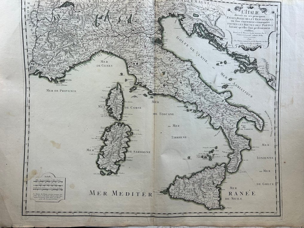
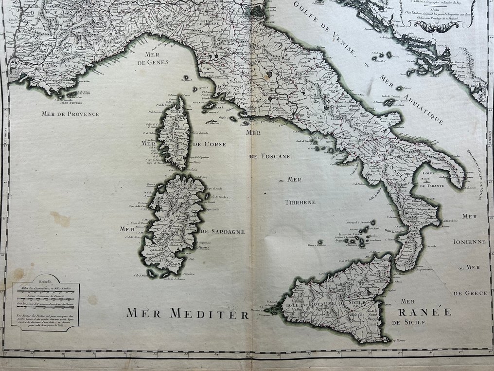
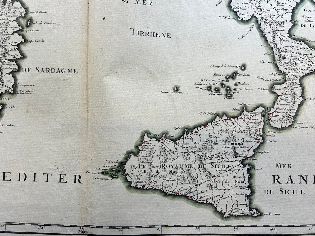
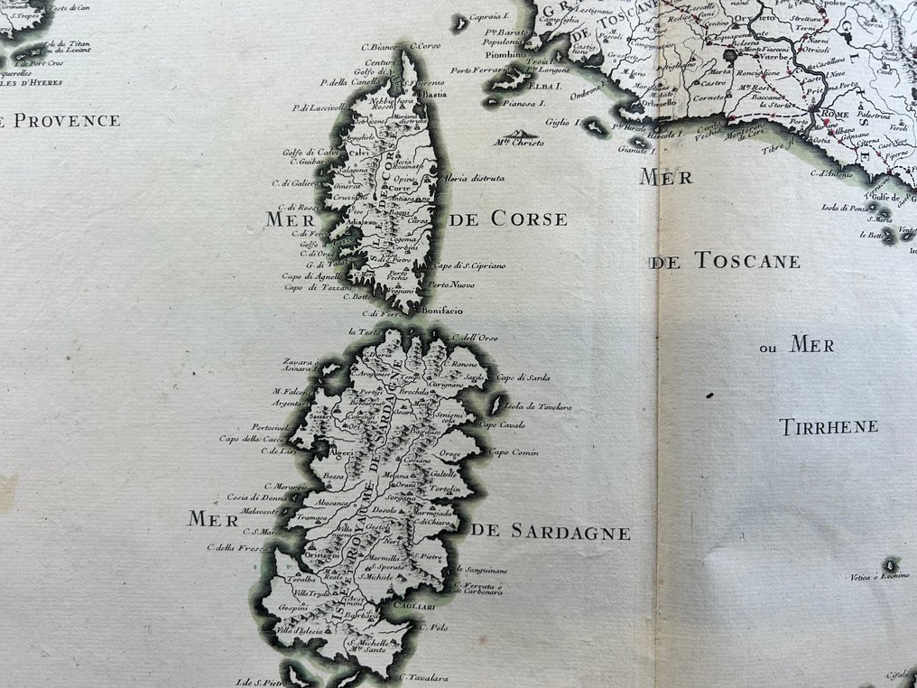
Italy - Italy / Sicily / Sardinia / Corsica / Istria (Pula, Rovinj, Poreč, Cittanova, Koper); Alexis-Hubert Jaillot (1632–1712) - L’Italie divisée en ses principaux Estats, Royaumes et Républiques… où sont exactement remarquées - 1701-1720

00
days
16
hours
42
minutes
33
seconds
Current bid
€ 221
No reserve price
Ilaria Colombo
Expert
Selected by Ilaria Colombo

Specialist in old books, specialising in theological disputes since 1999.

Estimate  € 140 - € 210
24 other people are watching this object
itBidder 2886 €221
itBidder 5407 €201
itBidder 2886 €191

Catawiki Buyer Protection

Your payment’s safe with us until you receive your object.View details

Trustpilot 4.4 | 121798 reviews

Rated Excellent on Trustpilot.

L’Italie divisée en ses principaux Estats, Royaumes et Républiques by Alexis-Hubert Jaillot, 1718 Paris; a finely hand colored plate of Italy including Sardegna, Corsica, Istria and Ragusa from Atlas Nouveau, perfect for Balkan and Venetian cartography fans.

AI-assisted summary

Description from the seller

Magnificent and extensive map of Italy published in Paris in 1718, taken from the Atlas Nouveau.
The work represents the entire Italian peninsula and includes in detail:
• Sardinia and Corsica
• Sicily
• Istria (now Croatia and Slovenia)
• Dalmatia
• Republic of Ragusa (now Dubrovnik, Croatia)
• Part of French Provence

A highly sought-after feature is the presence of all the main postal routes of the early eighteenth century, drawn with red lines across the entire map: a rare feature in French maps of the period.

The representation of Istria is particularly interesting: Jaillot shows Pula, Rovinj, Poreč, Novigrad, Umag, Koper and the entire Venetian coast, integrating the region into the communications network of the time.
An important detail for collectors of Balkan and Venetian cartography.

The baroque cartouche in the right margin confirms the date 1718 and the Parisian origin. The impression is clear and deep, a sign of an early and well-preserved print run.

Condition

Good/excellent:
• Original central fold from atlas.
• Healthy paper, wide margins.
• Slight yellowing and old stains on the upper left side, consistent with age.
• No visible tears, very fresh print.

Details

Era
1400-1900
Number of items
1
Country
Italy
Geographical specification
Italy / Sicily / Sardinia / Corsica / Istria (Pula, Rovinj, Poreč, Cittanova, Koper)
Map maker/ publisher
Alexis-Hubert Jaillot (1632–1712)
Map/ Book title
L’Italie divisée en ses principaux Estats, Royaumes et Républiques… où sont exactement remarquées
Period
1701-1720
Condition
Good
Technique
Copper engraving
Additional Information
Atlas Nouveau
Map colour
Contemporary hand colour
Height
510 mm
Width
620 mm
Sold by
ItalyVerified
3189
Objects sold
100%
protop

Similar objects

For you in

Maps