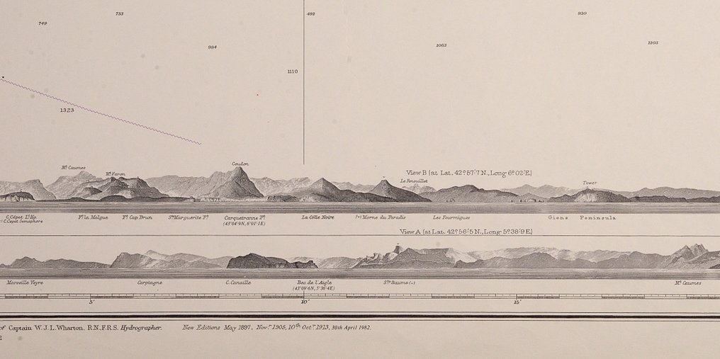
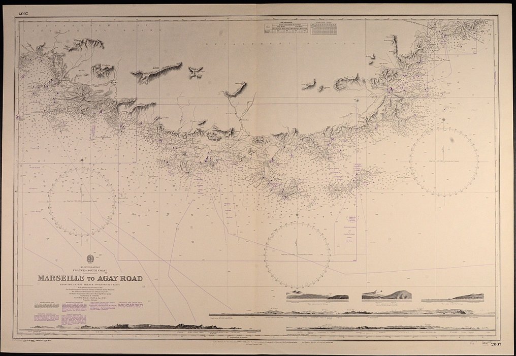
6 Nautical, Maritime charts with land views - Mediterranean and Red Sea; British Admiralty - zeekaart, zee kaart - 1858/1954

04
days
15
hours
59
minutes
45
seconds
Current bid
€ 35
No reserve price
33 other people are watching this object
itBidder 7705 €35
esBidder 7039 €30
esBidder 7039 €26

Catawiki Buyer Protection

Your payment’s safe with us until you receive your object.View details

Trustpilot 4.4 | 121798 reviews

Rated Excellent on Trustpilot.

Six British Admiralty nautical charts of the Mediterranean Sea and the Red Sea, uncoloured lithographs, each 71 by 104 cm, published between 1858 and 1954, in good condition and suitable for framing.

AI-assisted summary

Description from the seller


Six interesting sea charts of the British Admiralty of the Mediterranean Sea and the Red Sea (Syria, Egypt, France etc).
Mostly published in the 19th century. All with nice land views.
The charts are mostly very detailed and published in the 20th century.
Condition: good. Suitable for framing.

2592 - Red Sea, Perim Island, published 1874, 2nd edition, unused, views
2607 - Marseille to Agay Road, published 1893, 3rd edition, unused, views
2608 - Approaches to Toulon, published 1893, 5th edition, unused, views
2609 - Rade d'Agay to San remo, published 1858, 4th edition, unused, views
2630 - Alexandria to Port Said, published 1925, 2nd edition, large chart
2633 - Syria and Lebanon, Latakia to Sour, published 1954, 1rst edition, slight foxing, views

Details

Era
1400-1900
Manufacturer/ Brand
British Admiralty
Over 200 years old
No
Number of items
6
Country
6 Nautical, Maritime charts with land views
Geographical specification
Mediterranean and Red Sea
Map maker/ publisher
British Admiralty
Map/ Book title
zeekaart, zee kaart
Period
1858/1954
Condition
Good
Technique
Lithography
Additional Information
World wide sea charts. Zeekaart, zee kaart. CW26
Map colour
Uncoloured map
Height
71 cm
Width
104 cm
The NetherlandsVerified
170
Objects sold
100%
Private

Similar objects

For you in

Maps