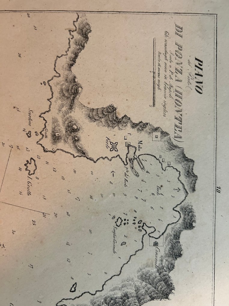
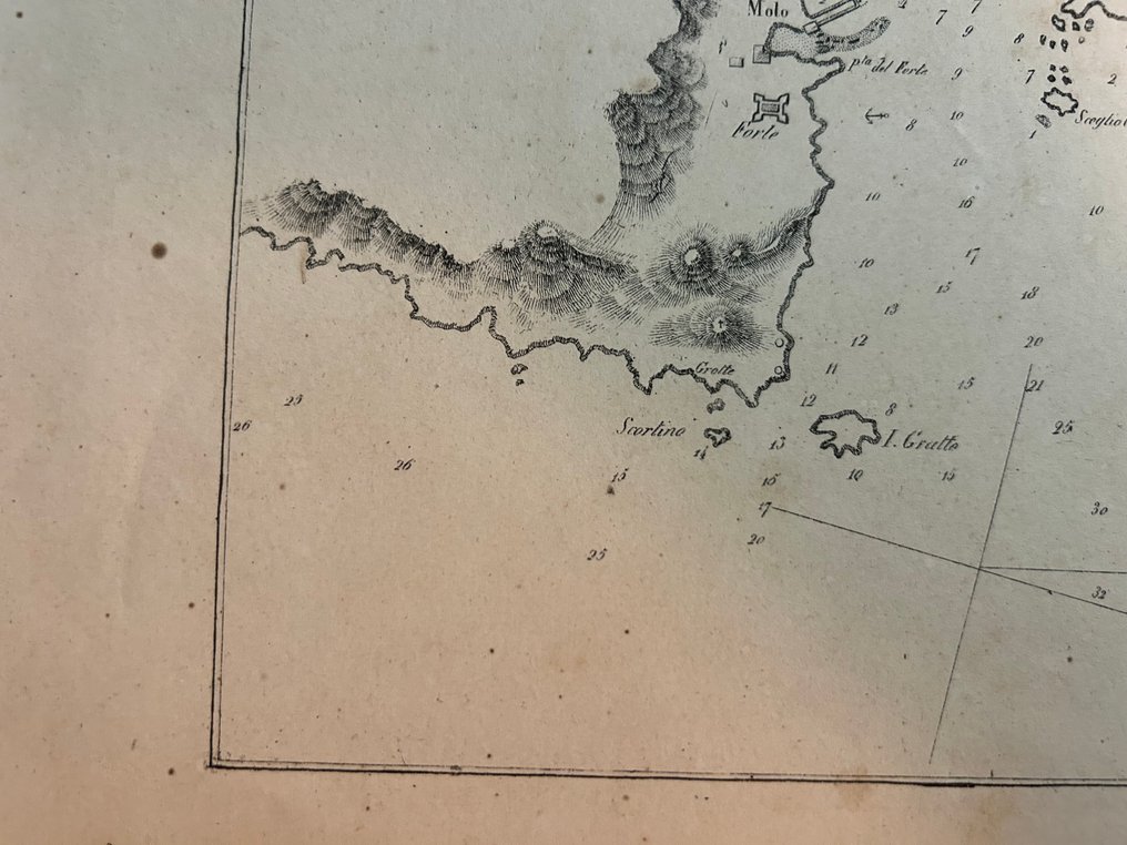
Italy - /Ponza // Grottone, // Gaviotta; Tommaso Santarelli - Piano del Porto di Ponza “PIANO del Porto DI PONZA (MONTEA) Isola a P. di Napoli. Gli scandagli sono - 1861-1880

00
days
16
hours
03
minutes
59
seconds
Current bid
€ 23
No reserve price
Ilaria Colombo
Expert
Selected by Ilaria Colombo

Specialist in old books, specialising in theological disputes since 1999.

Estimate  € 140 - € 210
10 other people are watching this object
itBidder 5305 €23
itBidder 6636 €18
esBidder 3134 €16

Catawiki Buyer Protection

Your payment’s safe with us until you receive your object.View details

Trustpilot 4.4 | 121798 reviews

Rated Excellent on Trustpilot.

Piano del Porto di Ponza, a 19th‑century copperplate engraving by Tommaso Santarelli, Italy, showing the Ponza harbour with mole, fort, built‑up area and nearby islets such as I. di Gaviotta; 210 × 160 mm, uncoloured.

AI-assisted summary

Description from the seller

A rare 19th-century nautical chart engraved by Saverio Santolini, active in Rome in the first half of the 19th century and known for his high-precision cartographic plates, portolans, and topographical charts. The signature is clearly legible at the bottom left: "Tav. S. Santolini in Roma."

The plate represents the "Port Plan of Ponza (Mountain)", with an accurate survey of the coasts, promontories, and hills using chiaroscuro hatching, according to the Italian technical tradition of the time. It shows the main port structures, including the pier, the fort, the urbanized areas, and the surrounding islets.

The grid of numbered backgrounds immediately identifies the document's nautical purpose: a chart intended for coastal navigation and safe entry into the port of Ponza. The Neapolitan scale, typical of the Bourbon period, is also present, although the engraving was made in Rome.

The card shows:
– the port of Ponza with the pier and the urban area
– the raised fort to protect the basin
– detection of the coasts through dense hatching
– numbered seabeds for navigation
– Smaller islands, including I. di Gaviotta (ancient toponym)
– route directions with bearing lines

Good.
Contemporary paper is slightly browned, with typical spotty oxidation and signs of aging consistent with its age. No tears, intact margins. The front is clear; the back is clean.

Details

Era
1400-1900
Number of items
1
Country
Italy
Geographical specification
/Ponza // Grottone, // Gaviotta
Map maker/ publisher
Tommaso Santarelli
Map/ Book title
Piano del Porto di Ponza “PIANO del Porto DI PONZA (MONTEA) Isola a P. di Napoli. Gli scandagli sono
Period
1861-1880
Condition
Good
Technique
Copper engraving
Additional Information
Maritime Atlas of the Kingdom of Italy
Map colour
Uncoloured map
Height
210 mm
Width
160 mm
Sold by
ItalyVerified
3189
Objects sold
100%
protop

Similar objects

For you in

Maps