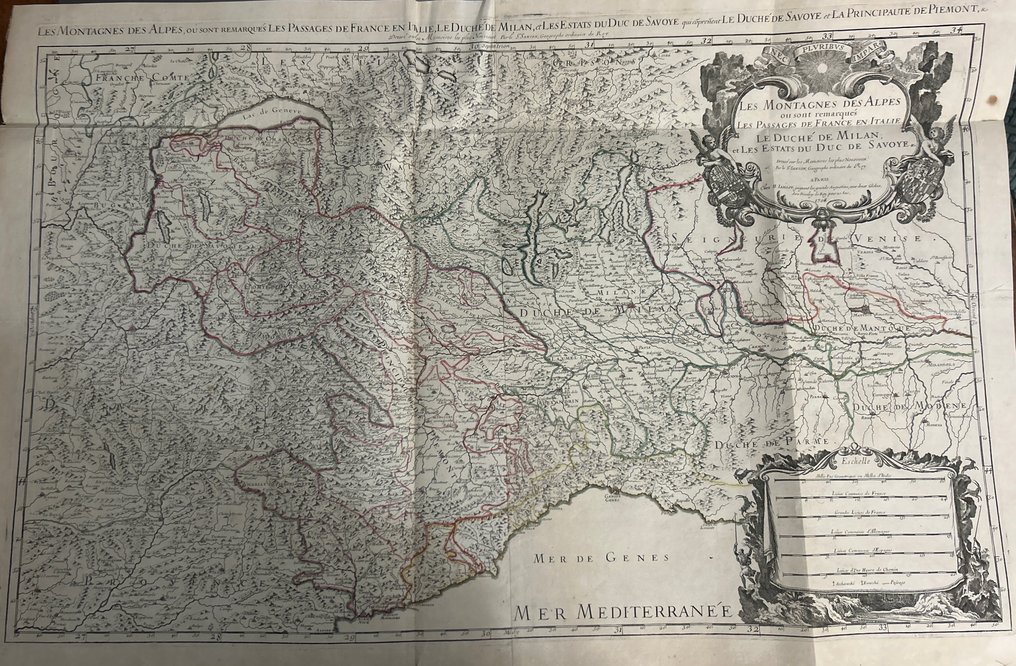
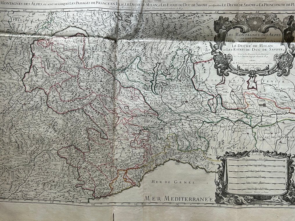
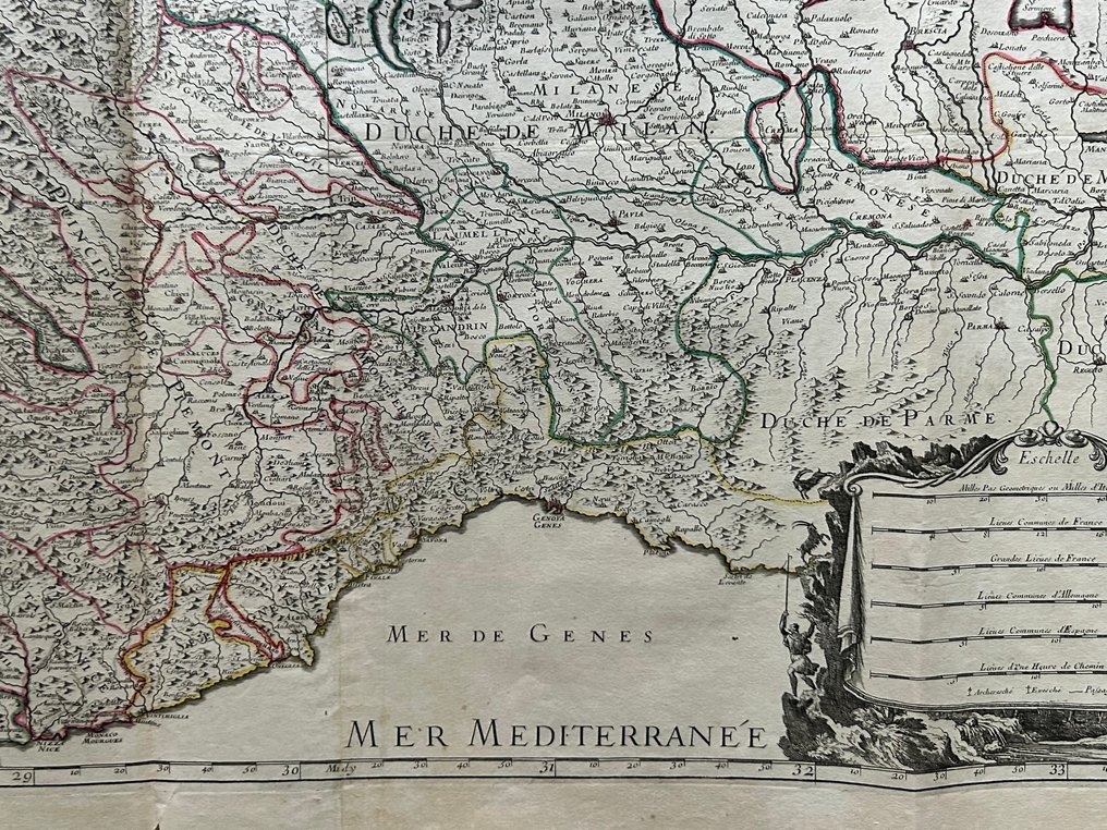
Italy - France and Italy, the Duchy of Milan, the States of the Duke of Savoy, Piedmont, and part of the; Hubert Jaillot (1632–1712) - “Les Montagnes des Alpes… Les Passages de France en Italie, le Duché de Milan, et les Estats du Duc - 1701-1720

00
days
17
hours
23
minutes
04
seconds
Current bid
€ 171
No reserve price
Ilaria Colombo
Expert
Selected by Ilaria Colombo

Specialist in old books, specialising in theological disputes since 1999.

Estimate  € 150 - € 200
22 other people are watching this object
frBidder 6342 €171
itBidder 5545 €161
frBidder 6342 €151

Catawiki Buyer Protection

Your payment’s safe with us until you receive your object.View details

Trustpilot 4.4 | 121798 reviews

Rated Excellent on Trustpilot.

This 1708 Jaillot map of the western Alps covers France and Italy, the Duchy of Milan and Savoy, with hand color and a grand baroque cartouche.

AI-assisted summary

Description from the seller

Magnificent and highly detailed map of the Western Alps, published in Paris in 1708 by the royal cartographer Hubert Jaillot, based on the works of Nicolas Sanson, geographer to the King of France.

The map depicts the main Alpine passes between France and Italy, the Duchy of Milan, the States of the Duke of Savoy, Piedmont, and part of the Republic of Venice, with exceptional topographical detail. The large baroque cartouche and heraldic coats of arms lend a strong aesthetic presence.


The paper features a clear period watermark (visible when held up to the light in the uploaded photos), consisting of a large circle with letters and internal motifs, typical of French paper mills of the early eighteenth century.

Center fold, light browning and foxing, typical of papers of the period. Sturdy paper, well-defined watermark. No significant losses.

Ancient outline coloring on political borders
• Lombardy → red outline
• States of Savoy → yellow outline
• Republic of Venice → red/pink outline
• Alps → not colored inside
• All border lines marked with brush strokes

Details

Era
1400-1900
Number of items
1
Country
Italy
Geographical specification
France and Italy, the Duchy of Milan, the States of the Duke of Savoy, Piedmont, and part of the
Map maker/ publisher
Hubert Jaillot (1632–1712)
Map/ Book title
“Les Montagnes des Alpes… Les Passages de France en Italie, le Duché de Milan, et les Estats du Duc
Period
1701-1720
Condition
Excellent
Technique
Copper engraving
Additional Information
Atlas Nouveau (edition 1708)
Map colour
Contemporary hand colour
Height
570 mm
Width
880 mm
Sold by
ItalyVerified
3189
Objects sold
100%
protop

Similar objects

For you in

Maps