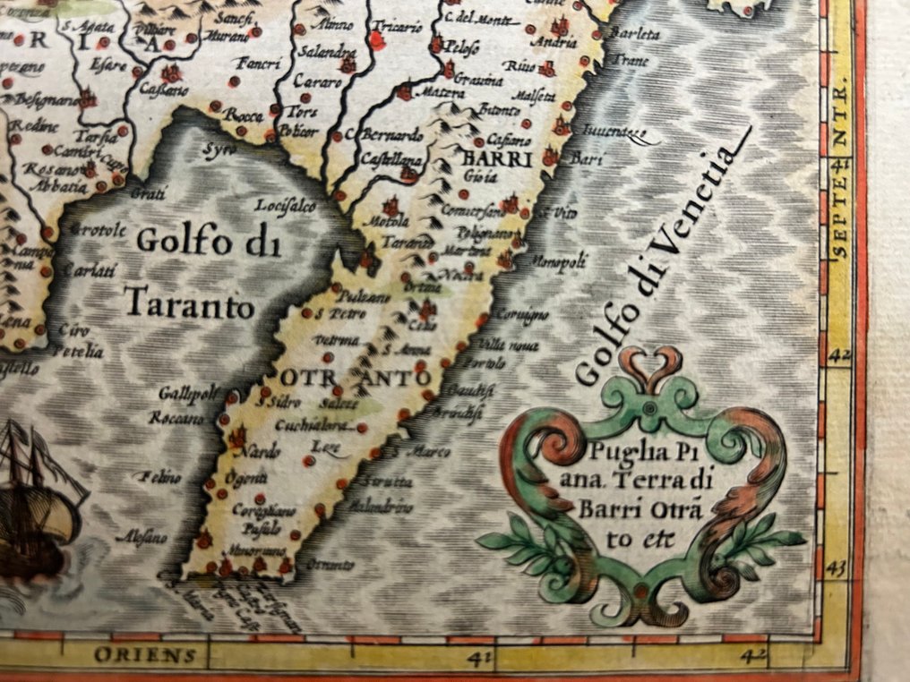
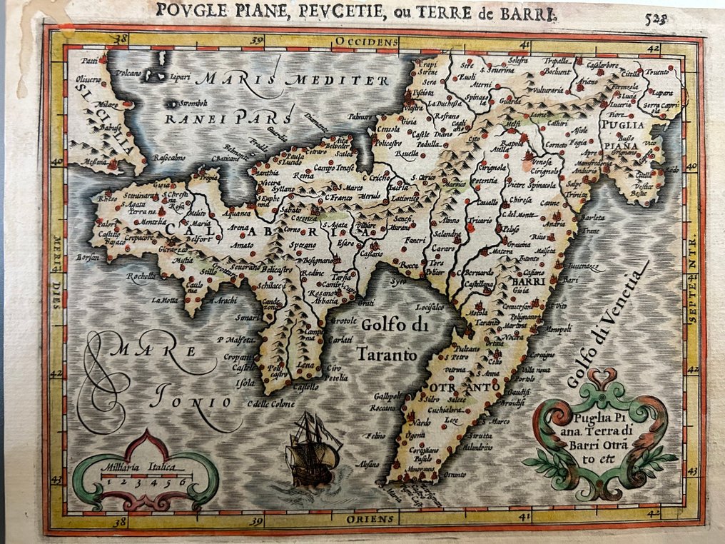
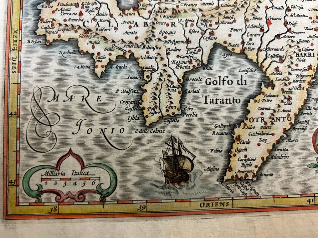
Italy - Gulf of Taranto, Strait of Otranto, and the main Apulian centers: Bari, Brindisi, Lecce.; Abraham Ortelius (1527-1598) - Povgle Piane, Pevcetie, ou Terre de Bari” - 1601-1620

00
days
16
hours
05
minutes
48
seconds
Current bid
€ 35
No reserve price
Ilaria Colombo
Expert
Selected by Ilaria Colombo

Specialist in old books, specialising in theological disputes since 1999.

Estimate  € 200 - € 250
35 other people are watching this object
itBidder 6440 €35
itBidder 7435 €30
itBidder 3255 €30

Catawiki Buyer Protection

Your payment’s safe with us until you receive your object.View details

Trustpilot 4.4 | 121798 reviews

Rated Excellent on Trustpilot.

Map book titled Povgle Piane, Pevcetie, ou Terre de Bari by Abraham Ortelius, Italy, depicting Golfo di Taranto, Canale d’Otranto and the main Apulian centres Bari, Brindisi, Lecce; copper engraving with contemporary hand colouring, 160 × 175 mm, in good condition.

AI-assisted summary

Description from the seller

The original title is 'Povgle Piane, Pevcetie, or Land of Bari,' with a very detailed depiction of ancient Peucezia, the Gulf of Taranto, the Otranto Channel, and the main towns of Apulia: Bari, Brindisi, Lecce, Otranto, Taranto, Polignano, Monopoli, Gravina, Altamura, etc.

Specimen with period coloration, in excellent condition, featuring the typical 16th-century Dutch colors.
The sea is decorated with waves with a silver net-like appearance and a baroque sailing ship.

On the back side, the original text in French is present.

Small lack of paper in the upper left margin (outside the engraved image) and a slight old water stain in the same corner. Nothing that affects the incision. Otherwise, the sheet is solid, with very fresh antique coloring and the back side text complete.

Details

Era
1400-1900
Number of items
1
Country
Italy
Geographical specification
Gulf of Taranto, Strait of Otranto, and the main Apulian centers: Bari, Brindisi, Lecce.
Map maker/ publisher
Abraham Ortelius (1527-1598)
Map/ Book title
Povgle Piane, Pevcetie, ou Terre de Bari”
Period
1601-1620
Condition
Good
Technique
Copper engraving
Additional Information
Theatrum Orbis Terrarum –
Map colour
Contemporary hand colour
Height
160 mm
Width
175 mm
Sold by
ItalyVerified
3189
Objects sold
100%
protop

Similar objects

For you in

Maps