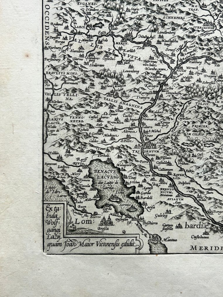
Italy - Trento, Innsbruck, Merano, Bolzano, and Brenner; Wolfgang Lazius (1514–1565) - Rhetiae Alpestris Descriptio, in qua hodie Tirolis Comitatus - 1581-1600

00
days
16
hours
47
minutes
26
seconds
Current bid
€ 30
No reserve price
Ilaria Colombo
Expert
Selected by Ilaria Colombo

Specialist in old books, specialising in theological disputes since 1999.

Estimate  € 140 - € 210
18 other people are watching this object
itBidder 8951 €30
itBidder 0790 €25
itBidder 0790 €21

Catawiki Buyer Protection

Your payment’s safe with us until you receive your object.View details

Trustpilot 4.4 | 121798 reviews

Rated Excellent on Trustpilot.

This Renaissance map of the Tyrol from Theatrum Orbis Terrarum, based on Wolfgang Lazius, shows Trento, Innsbruck, Merano, Bolzano and the Brenner with rich topographic detail.

AI-assisted summary

Description from the seller

Splendid Renaissance map of Tyrol from Ortelius's Theatrum Orbis Terrarum, based on the original plate by Wolfgang Lazius. The engraving is rich in topographical detail, depicting the Alps, Trento, Innsbruck, Merano, Bolzano, and the Brenner Pass. This copy of the French edition is in excellent condition and has wide margins. Rare and highly decorative.

Elegant cartouche in late Renaissance style.
• Very dense representation of mountains, forests and rivers.
• Populated by hundreds of historical toponyms that have now changed or disappeared.
• Rare scroll at bottom left: “Ex tabula Wolfgangi Lazi… quam Joan Maur Vienne… exhib.”
• Text on the back in French

Details

Era
1400-1900
Number of items
1
Country
Italy
Geographical specification
Trento, Innsbruck, Merano, Bolzano, and Brenner
Map maker/ publisher
Wolfgang Lazius (1514–1565)
Map/ Book title
Rhetiae Alpestris Descriptio, in qua hodie Tirolis Comitatus
Period
1581-1600
Condition
Excellent
Technique
Copper engraving
Additional Information
Theatrum Orbis Terrarum
Map colour
Uncoloured map
Height
420 mm
Width
300 mm
Sold by
ItalyVerified
3189
Objects sold
100%
protop

Similar objects

For you in

Maps