Louis Brion de La Tour – Robert Lefebvre - Atlas Itineraire de L’Europe, adaptè, quant à la France, aux Messageries Royales, Nouvelle - 1776


Opens 11:00
Starting bid
€ 1
Add to your favourites to get an alert when the auction starts.

Expert
Selected by Ilaria Colombo
Specialist in old books, specialising in theological disputes since 1999.
Estimate € 750 - € 1,200
Catawiki Buyer Protection
Your payment’s safe with us until you receive your object.View details
Trustpilot 4.4 | 121798 reviews
Rated Excellent on Trustpilot.
Description from the seller
Atlas Itinerary of Europe, adapted with regard to France, for the Royal Mail, new diligences, dedicated and presented to Monseigneur Turgot – by Mr. Brion, King's Engineer-Geographer – in Paris, on the 1st of May 1776.
First edition of this atlas of France by the designer and cartographer Louis Brion de La Tour, who gained great fame in the second half of the 1700s in France. The atlas was created with the aim of teaching young people the basics of geography. The volume contains, in addition to the geographical map of France and a plate of the same divided into rectangles, 60 plates with itineraries and distances along communication routes from Paris to other cities in France and neighboring countries.
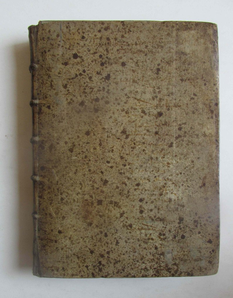
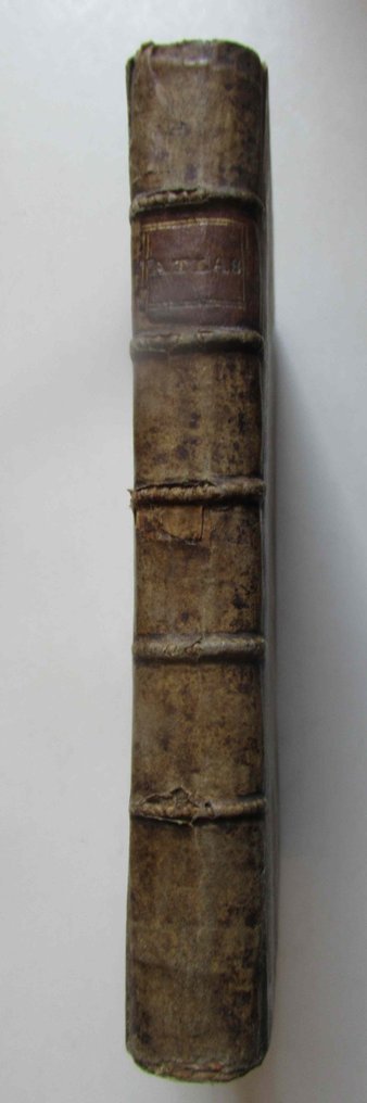
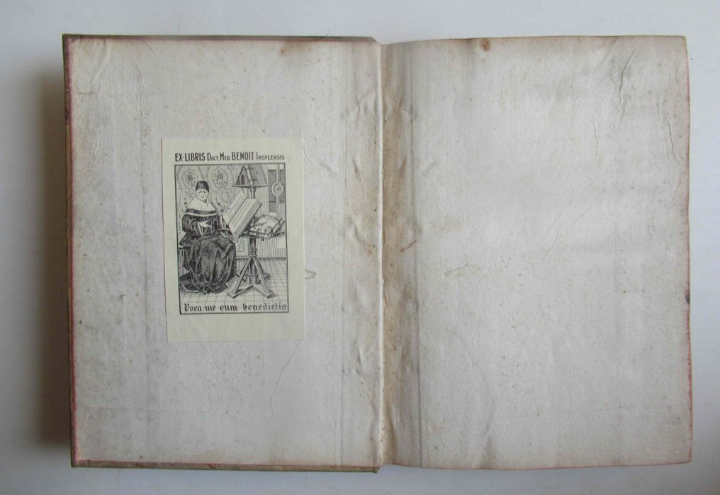
Contemporary binding in marbled leather, scuffs and abrasions on the covers with slightly chipped corners, worn spine with five ribs and compartments, dark leather label with gilded title, neutral endpapers and dark edges, former ownership mark on the front endpaper; upper hinge damaged. Dimensions 195x145mm.
Title page in black characters inserted in an elaborate frame with embossed putti engraved in copper by Lefebvre, totaling 62 double-page copper engravings on handmade paper mounted on tabs and in good condition, with a central fold and colored edges, small print smudges, oxidation, foxing, and traces of dirt at the margins on the plates.
Insured shipping with costs depending on the destination continent.
Atlas Itinerary of Europe, adapted with regard to France, for the Royal Mail, new diligences, dedicated and presented to Monseigneur Turgot – by Mr. Brion, King's Engineer-Geographer – in Paris, on the 1st of May 1776.
First edition of this atlas of France by the designer and cartographer Louis Brion de La Tour, who gained great fame in the second half of the 1700s in France. The atlas was created with the aim of teaching young people the basics of geography. The volume contains, in addition to the geographical map of France and a plate of the same divided into rectangles, 60 plates with itineraries and distances along communication routes from Paris to other cities in France and neighboring countries.
Contemporary binding in marbled leather, scuffs and abrasions on the covers with slightly chipped corners, worn spine with five ribs and compartments, dark leather label with gilded title, neutral endpapers and dark edges, former ownership mark on the front endpaper; upper hinge damaged. Dimensions 195x145mm.
Title page in black characters inserted in an elaborate frame with embossed putti engraved in copper by Lefebvre, totaling 62 double-page copper engravings on handmade paper mounted on tabs and in good condition, with a central fold and colored edges, small print smudges, oxidation, foxing, and traces of dirt at the margins on the plates.
Insured shipping with costs depending on the destination continent.
Details
Number of Books
1
Subject
Geography, Travels
Book Title
Atlas Itineraire de L’Europe, adaptè, quant à la France, aux Messageries Royales, Nouvelle
Author/ Illustrator
Louis Brion de La Tour – Robert Lefebvre
Condition
Good
Publication year oldest item
1776
Height
195 mm
Edition
Illustrated Edition
Width
145 mm
Language
French
Original language
Yes
Publisher
Louis Brion de la Tour - Parigi
Binding/ Material
Leather
Extras
Fold out maps or plates
Number of pages
62
