France - Italy; Eustache Hyacinthe Langlois - ITALIE - 1781-1800


05
days
15
hours
58
minutes
02
seconds
Starting bid
€ 1
No reserve price

Expert
Selected by Ilaria Colombo
Specialist in old books, specialising in theological disputes since 1999.
Estimate € 130 - € 190
No bids placed
Catawiki Buyer Protection
Your payment’s safe with us until you receive your object.View details
Trustpilot 4.4 | 121798 reviews
Rated Excellent on Trustpilot.
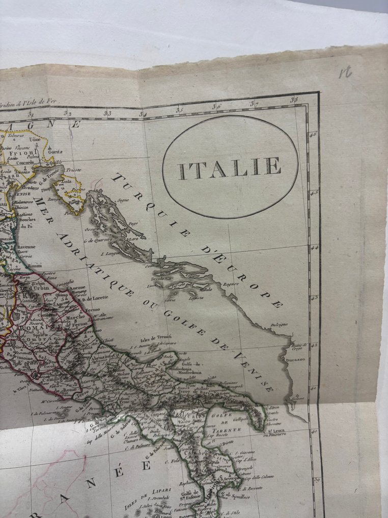
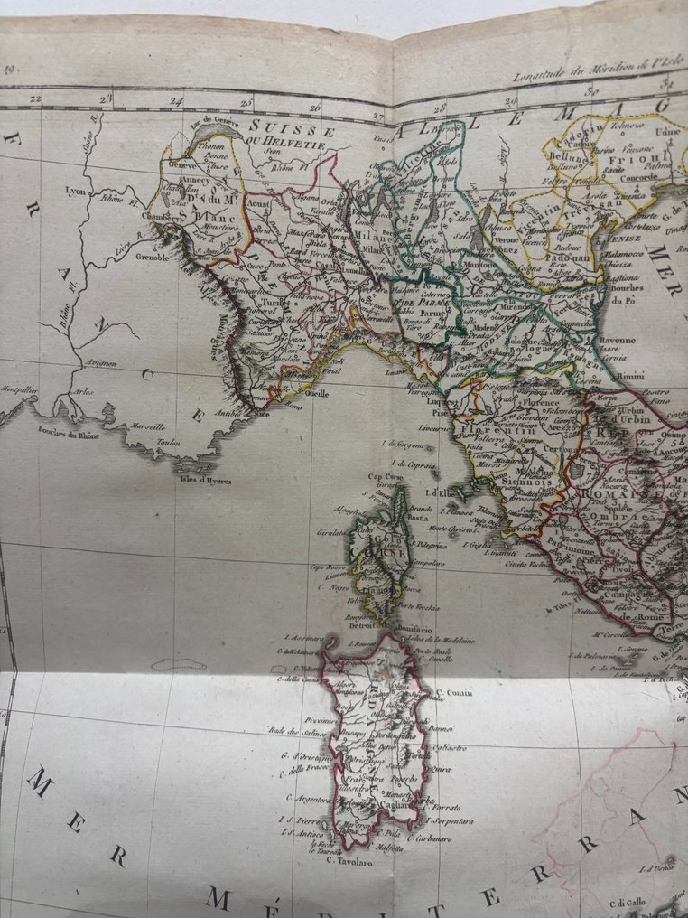
ITALIE, an old French-language map of Italy engraved in aquaforte and hand-coloured, published in France by Eustache Hyacinthe Langlois as part of Atlas Universel for Guthrie's Geography, showing the preunitary states with differently coloured borders and measuring 38 × 44 cm.
AI-assisted summary
Description from the seller
The map is an ancient geographical map of Italy, printed in French. It is created with engraving and manual coloring of the borders, typical of maps published between the late eighteenth and early nineteenth centuries.
The title 'ITALY' appears in a large circle at the top right. The Italian peninsula is depicted along with the major islands of Sicily, Sardinia, and Corsica. It does not show a united Italy: the different pre-unification states are outlined in different colors (Kingdom of Sardinia, Papal States, Kingdom of Naples, etc.).
To the north, borders with Switzerland and the Austrian Empire are indicated, while to the east is the coast of European Turkey. To the south, beyond the Mediterranean, the coast of North Africa appears.
Numerous historical toponyms are listed, in French, with details about cities, rivers, and regions. The geographic grid lines and meridians/parallels are drawn along the edges. The presence of numbering in the upper left corner indicates that it was part of a geographic atlas. The print is in good condition, with book folds and a hole on the map visible in the photo.
Details
Era
1400-1900
Manufacturer/ Brand
Eustache Hyacinthe Langlois
Country
France
Geographical specification
Italy
Map maker/ publisher
Eustache Hyacinthe Langlois
Map/ Book title
ITALIE
Period
1781-1800
Condition
Good
Technique
Etching
Additional Information
Universal Atlas, for Guthrie's geography.
Map colour
Later hand colour
Height
38 cm
Width
44 cm
