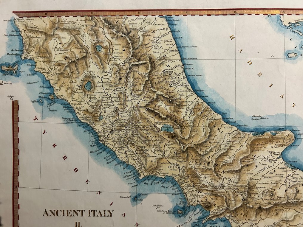
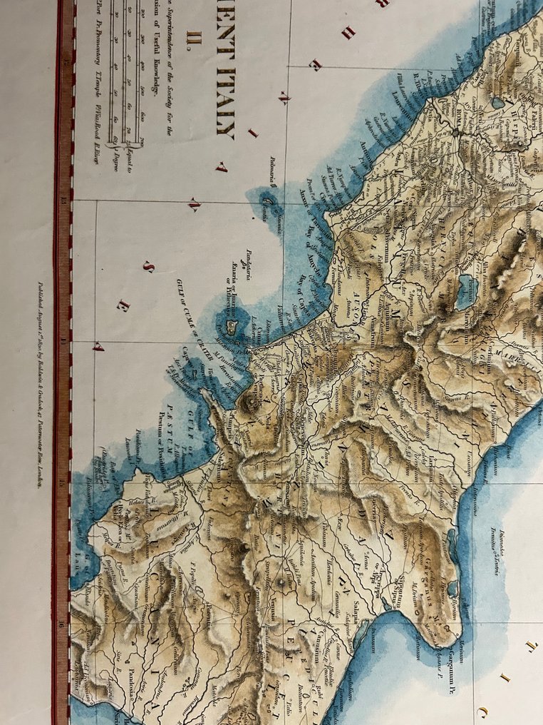
Italy - Lazio • Campania • Basilicata • Calabria • Tuscany (for the area of the Island of Elba); John & Charles Walker/ Society for the Diffusion of Useful Knowledge (SDUK) - Ancient Italy II - 1821-1850

05
days
14
hours
54
minutes
13
seconds
Current bid
€ 1
No reserve price
Ilaria Colombo
Expert
Selected by Ilaria Colombo

Specialist in old books, specialising in theological disputes since 1999.

Estimate  € 140 - € 210
4 other people are watching this object
itBidder 8835 €1

Catawiki Buyer Protection

Your payment’s safe with us until you receive your object.View details

Trustpilot 4.4 | 121798 reviews

Rated Excellent on Trustpilot.

Ancient Italy II, a steel-engraved, hand-coloured map published by John & Charles Walker/ Society for the Diffusion of Useful Knowledge (SDUK) in Italy, covering Lazio, Campania, Basilicata, Calabria and Toscana (Elba), size 330 × 400 mm, in excellent condition.

AI-assisted summary

Description from the seller

The Ancient Italy II map, published by the Society for the Diffusion of Useful Knowledge around 1840, accurately depicts the central-southern part of ancient Italy. The engraving shows key territories of the peninsula during the Roman era, highlighting historical borders, major Latin cities, and connecting routes.

The covered area includes southern Etruria, Latium Vetus with Rome centrally located, Latium Adiectum extended southward, all of ancient Campania with Capua, Neapolis, and the gulf carefully outlined, then Lucania and Bruttium, which occupy the entire final part of the peninsula up to the extreme tip of Calabria. In the northwestern portion, the island of Elba (Ilva) is clearly visible, drawn with defined contours and Latin toponyms.

The map is enhanced by the classic SDUK double-line colored border and a scale table in Roman miles, itineraries, and British miles. The reliefs are rendered through fine hatching, and the boundaries of ancient regions are highlighted with period coloring. The enlargement of the central territories allows for very clear reading of the inhabited centers, main rivers, promontories, and coasts, which feature a blue coloration typical of the most refined editions of the series.

Details

Era
1400-1900
Number of items
1
Country
Italy
Geographical specification
Lazio • Campania • Basilicata • Calabria • Tuscany (for the area of the Island of Elba)
Map maker/ publisher
John & Charles Walker/ Society for the Diffusion of Useful Knowledge (SDUK)
Designer/Artist/Maker
“B.R. Davies, sculp., 16 George St. Euston Square.”
Map/ Book title
Ancient Italy II
Period
1821-1850
Condition
Excellent
Technique
Steel engraving
Additional Information
SDUK – Maps of the Principal Cities of the World
Map colour
Later hand colour
Height
330 mm
Width
400 mm
Sold by
ItalyVerified
3189
Objects sold
100%
protop

Similar objects

For you in

Maps