Netherlands - Cities in the Netherlands and Belgium; Frederick de Wit - Atlas de Wit - 1681-1700


04
days
14
hours
08
minutes
57
seconds

19 other people are watching this object
 Bidder 4168 Bidder 4168 | €9 | |
|---|---|---|
| Bidder 7493 | €8 | |
| Bidder 4168 | €5 | |
Catawiki Buyer Protection
Your payment’s safe with us until you receive your object.View details
Trustpilot 4.4 | 121798 reviews
Rated Excellent on Trustpilot.
Atlas de Wit by Frederick de Wit, Nederland, featuring cities in the Netherlands and Belgium; a large-format facsimile reprint (55 x 37 cm, 7 kg) in excellent/new condition with hardcover in its original box.
AI-assisted summary
Description from the seller
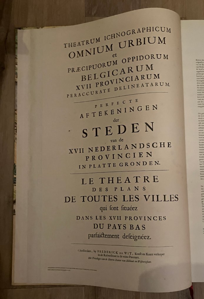
Theatrum Ichnographicum of All Cities and Principal Towns of the 17 Provinces of Belgium, accurately delineated, by Frederick de Wit, map and chart seller in the Kalverstraat in the White Pascaart, 1698 - Introduction: Marieke van Delft & Peter van der Krogt, trilingual: Dutch, French, and English - Facsimile edition: Tielt, Lannoo, 2012 - 320 pages - hardcover, with ribbon marker - 55 x 37 x 4.5 cm - weight: 7 kg. In original box.
Condition: in excellent condition.
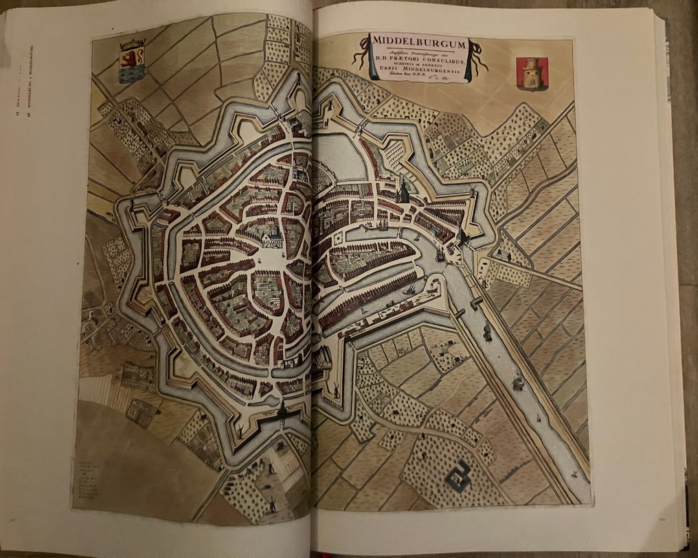
Magnificently executed facsimile atlas in large folio size, featuring 158 images of cities and monuments in the Netherlands and Belgium. This atlas is also known as the Google Earth of the Golden Age.
Atlas de Wit is a historic city atlas from 1698 featuring city maps and engravings of important monuments from the Northern and Southern Netherlands. Such atlases were popular among wealthy citizens and nobles in the 17th century. The Wits city atlas weighs no less than 7 kilograms. It is a book of great art and cultural historical importance, with detailed maps. Only five copies of this atlas are known worldwide. The beautiful maps, originally hand-colored, are drawn from a bird's-eye perspective.
This facsimile is made at life size with a new introduction by the then-conservator of old prints Marieke van Delft and cartographer Peter van der Krogt, along with a detailed description for each map. This publication makes a historical atlas accessible to all enthusiasts of history and old maps.
Theatrum Ichnographicum of All Cities and Principal Towns of the 17 Provinces of Belgium, accurately delineated, by Frederick de Wit, map and chart seller in the Kalverstraat in the White Pascaart, 1698 - Introduction: Marieke van Delft & Peter van der Krogt, trilingual: Dutch, French, and English - Facsimile edition: Tielt, Lannoo, 2012 - 320 pages - hardcover, with ribbon marker - 55 x 37 x 4.5 cm - weight: 7 kg. In original box.
Condition: in excellent condition.
Magnificently executed facsimile atlas in large folio size, featuring 158 images of cities and monuments in the Netherlands and Belgium. This atlas is also known as the Google Earth of the Golden Age.
Atlas de Wit is a historic city atlas from 1698 featuring city maps and engravings of important monuments from the Northern and Southern Netherlands. Such atlases were popular among wealthy citizens and nobles in the 17th century. The Wits city atlas weighs no less than 7 kilograms. It is a book of great art and cultural historical importance, with detailed maps. Only five copies of this atlas are known worldwide. The beautiful maps, originally hand-colored, are drawn from a bird's-eye perspective.
This facsimile is made at life size with a new introduction by the then-conservator of old prints Marieke van Delft and cartographer Peter van der Krogt, along with a detailed description for each map. This publication makes a historical atlas accessible to all enthusiasts of history and old maps.
Details
Era
1400-1900
Number of items
1
Country
Netherlands
Geographical specification
Cities in the Netherlands and Belgium
Map maker/ publisher
Frederick de Wit
Designer/Artist/Maker
Frederick de Wit
Map/ Book title
Atlas de Wit
Period
1681-1700
Condition
Excellent
Technique
print
Additional Information
Facsimile reprint in large format
Height
55 cm
Width
37 cm
