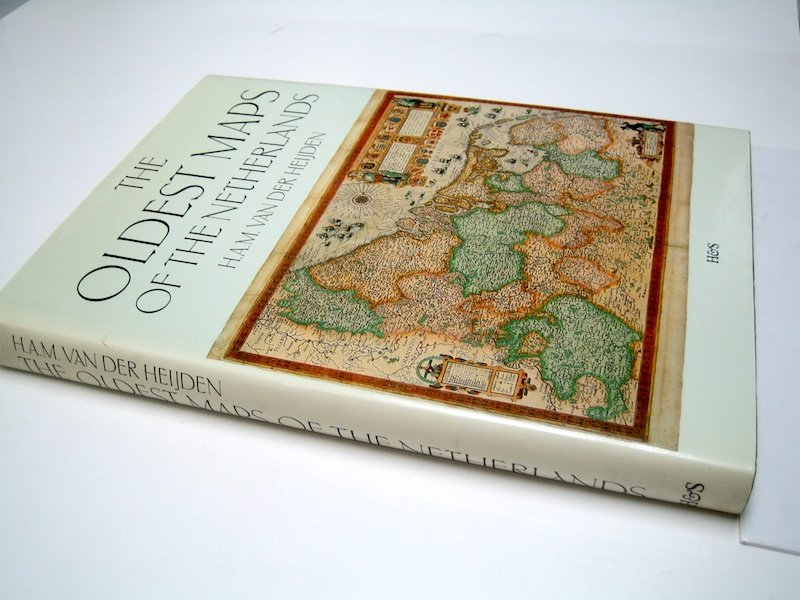
The Netherlands, Belgium and Luxembourg - The Netherlands of the XVII Provinces; H.A.M. van der Heijden - The Oldest Maps of the Netherlands - 1526-1599

04
days
19
hours
11
minutes
41
seconds
Current bid
€ 4
No reserve price
6 other people are watching this object
nlBidder 3917 €4
nlBidder 1653 €1

Catawiki Buyer Protection

Your payment’s safe with us until you receive your object.View details

Trustpilot 4.4 | 122813 reviews

Rated Excellent on Trustpilot.

The Oldest Maps of the Netherlands by H.A.M. van der Heijden, Utrecht HES Publishers, 1987, hardback with dust jacket, 230 pages, 25 × 18 cm, English text, mint condition.

AI-assisted summary

Description from the seller

The Oldest Maps of the Netherlands. An illustrated and annotated carto-bibliography of the 16th century maps of the XVII Provinces - H.A.M. van der Heijden - Utrecht, HES Publishers, 1987 - 230 pp - hardback with dust jacket - 25 x 18 cm. Language: English.

Mint condition.

A carto-bibliography, concerning the oldest maps (1526-1599)of the Netherlands of the XVII Provinces.

(total:1)

Details

Era
1400-1900
Over 200 years old
No
Number of items
1
Country
The Netherlands, Belgium and Luxembourg
Geographical specification
The Netherlands of the XVII Provinces
Map maker/ publisher
H.A.M. van der Heijden
Map/ Book title
The Oldest Maps of the Netherlands
Period
1526-1599
Condition
Excellent
Technique
print
Additional Information
With dust jacket
Height
25 cm
Width
18 cm
Sold by
The NetherlandsVerified
3955
Objects sold
100%
Privatetop

Similar objects

For you in

Maps