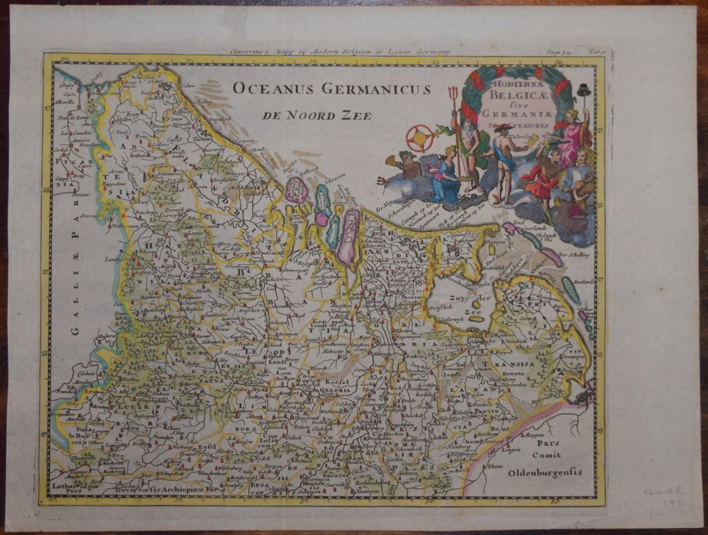
Netherlands - Netherlands and Belgium; Cluverius - HODIERNAE BELGICAE SIVE GERMANIAE INFERIORIS.. - 1701-1720

05
days
08
hours
14
minutes
15
seconds
Starting bid
€ 1
No reserve price
Ilaria Colombo
Expert
Selected by Ilaria Colombo

Specialist in old books, specialising in theological disputes since 1999.

Estimate  € 170 - € 210
No bids placed

Catawiki Buyer Protection

Your payment’s safe with us until you receive your object.View details

Trustpilot 4.4 | 122190 reviews

Rated Excellent on Trustpilot.

HODIERNAE BELGICAE SIVE GERMANIAE INFERIORIS.., produced by Cluverius, is a Netherlands map covering the Netherlands and Belgium, dating from 1701–1720, copper engraving with later hand colour, in excellent condition.

AI-assisted summary

Description from the seller


A highly decorative copper line engraved map produced to accompany the 1704 edition of Philip Cluver's "Introductio In Universam Geographiam", published in London by John Nicholson. A scarce item with a highly decorative cartouche.

Measures 205 x 250 mm. Excellent condition. Folds as issued.

Hand coloured.


A guaranteed genuine antique map.

Details

Era
1400-1900
Country
Netherlands
Geographical specification
Netherlands and Belgium
Map maker/ publisher
Cluverius
Map/ Book title
HODIERNAE BELGICAE SIVE GERMANIAE INFERIORIS..
Period
1701-1720
Condition
Excellent
Technique
Copper engraving
Additional Information
Detailed and decorative map of the area.
Map colour
Later hand colour
Height
200 mm
Width
250 mm
PortugalVerified
19
Objects sold
Private

Similar objects

For you in

Maps