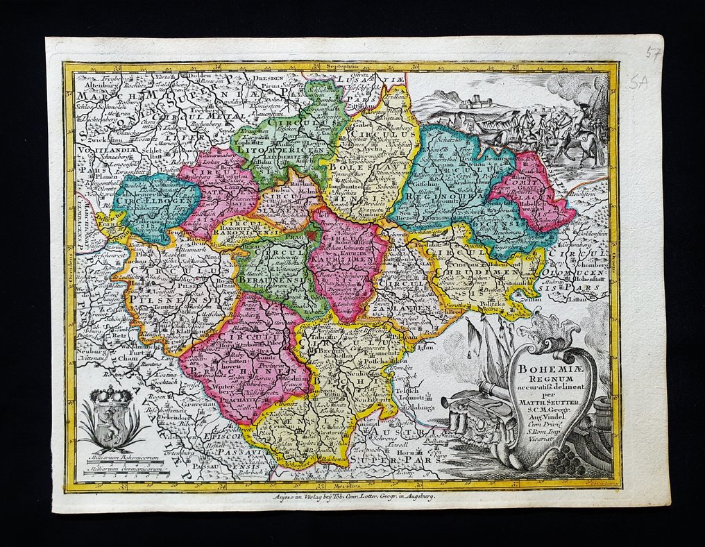
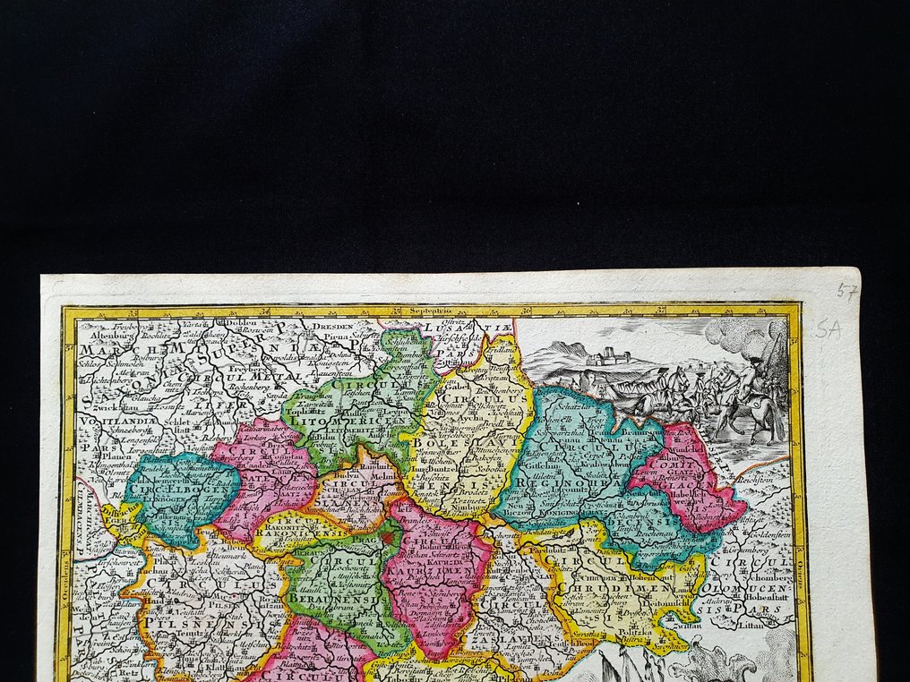
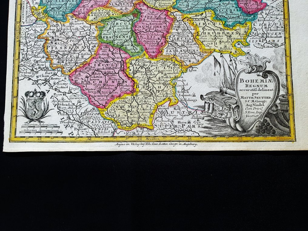
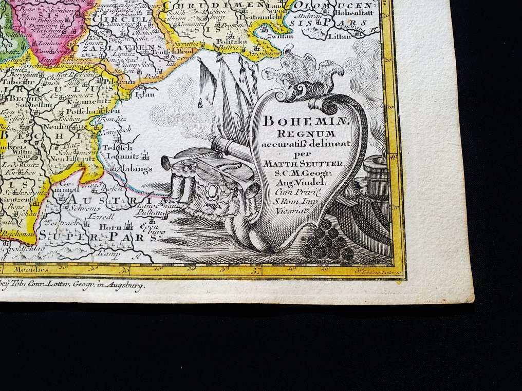
Europe - Czech Republic / Baltic Sea / Bohemia / Poland / Lithuania / Prague / Silesia / Brno / Moravia; Matthaus Seutter - Bohemiae Regnum - 1721-1750

08
days
23
hours
02
minutes
15
seconds

10 other people are watching this object
 Bidder 5437 Bidder 5437 | €1 |
|---|
Catawiki Buyer Protection
Your payment’s safe with us until you receive your object.View details
Trustpilot 4.4 | 122529 reviews
Rated Excellent on Trustpilot.
Bohemiae Regnum, by Matthaus Seutter, a hand-coloured copper-plate map of Europe dating circa 1720, showing the Czech Republic / Baltic Sea / Bohemia / Poland / Lithuania / Prague / Silesia / Brno / Moravia, with size 29 by 22 cm.
AI-assisted summary
Description from the seller
This rare geographical map is an original copper engraving from around 1720.
This is the very rare pocket edition of Matthäus Seutter's atlas, published in 1720, titled 'ATLAS MINOR - Atlas novus sive Tabulae geographicae totius Orbis faciem, partes, imperia, regna et provincias exhibentes exactissima cura iuxta recentissima observationae Matthaeus Seutter-Grosser Atlas,' which contains all the universal, special, and particular geographical maps of the entire world, including regions, empires, kingdoms, and provinces, created with the utmost precision according to the latest observations. Augsburg, 1720.
Beautiful map published in Germany, with excellent and original watercolor, wide margins, and geographically well detailed at every point.
Conditions: the conditions are truly more than good, excellent, as shown in the photo.
The overall dimensions of the map are: 29 cm x 22 cm.
Seller's Story
I am a private Catawiki seller and I sell collectibles, a wonderful world.
Translated by Google TranslateThis rare geographical map is an original copper engraving from around 1720.
This is the very rare pocket edition of Matthäus Seutter's atlas, published in 1720, titled 'ATLAS MINOR - Atlas novus sive Tabulae geographicae totius Orbis faciem, partes, imperia, regna et provincias exhibentes exactissima cura iuxta recentissima observationae Matthaeus Seutter-Grosser Atlas,' which contains all the universal, special, and particular geographical maps of the entire world, including regions, empires, kingdoms, and provinces, created with the utmost precision according to the latest observations. Augsburg, 1720.
Beautiful map published in Germany, with excellent and original watercolor, wide margins, and geographically well detailed at every point.
Conditions: the conditions are truly more than good, excellent, as shown in the photo.
The overall dimensions of the map are: 29 cm x 22 cm.
Seller's Story
I am a private Catawiki seller and I sell collectibles, a wonderful world.
Translated by Google TranslateDetails
Era
1400-1900
Number of items
1
Country
Europe
Geographical specification
Czech Republic / Baltic Sea / Bohemia / Poland / Lithuania / Prague / Silesia / Brno / Moravia
Map maker/ publisher
Matthaus Seutter
Designer/Artist/Maker
Matthaus Seutter
Map/ Book title
Bohemiae Regnum
Period
1721-1750
Condition
Excellent
Technique
Copper engraving
Additional Information
Original colored copper plate
Map colour
Contemporary hand colour
Height
29 cm
Width
22 cm
Sold by
