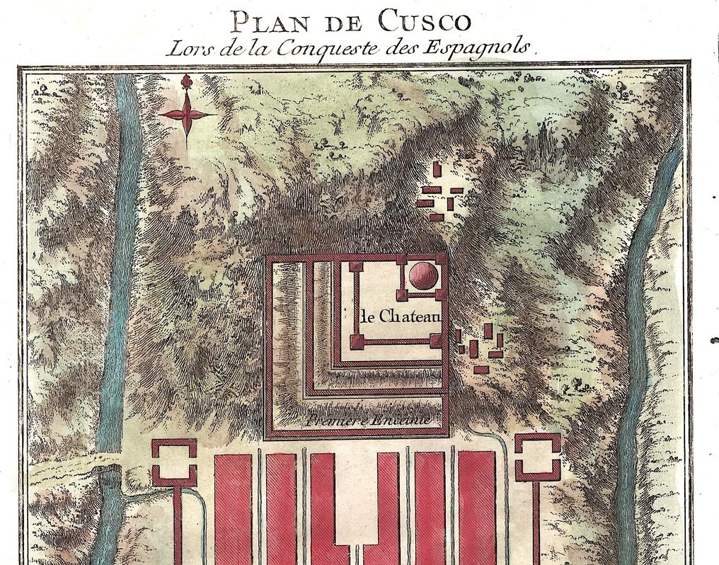
Peru - Cusco; N. Bellin - Plan de Cusco Lors de la Conqueste des Espagnols - 1751-1760

00
days
12
hours
34
minutes
07
seconds
Current bid
€ 2
No reserve price
11 other people are watching this object
frBidder 7452 €2

Catawiki Buyer Protection

Your payment’s safe with us until you receive your object.View details

Trustpilot 4.4 | 123536 reviews

Rated Excellent on Trustpilot.

Plan de Cusco Lors de la Conqueste des Espagnols, an original antique copper engraving by N. Bellin of Cusco, Peru, with later hand colour, sheet size 25 × 18 cm.

AI-assisted summary

Description from the seller

Dimensions: 18.5 x 15 cm. (on sheet: 25 x 18 cm.).

Condition: Very good
Verso: blank.

Author: Antoine Francois Prevost
Mapmaker: N. Bellin
Publisher: Didot. Paris.
Note: from "Histoire generale des Voyages ou nouvelle collection de toutes les relations de voyages"

Jacques-Nicolas Bellin (1703-1772) was among the most important mapmakers of the eighteenth century. In 1721, at only the age of 18, he was appointed Hydrographer to the French Navy. In August 1741, he became the first Ingénieur de la Marine of the Dépôt des cartes et plans de la Marine. Bellin set a very high standard of workmanship and accuracy, cementing France's leading role in European cartography and geography during this period. Many of his maps were copied by other mapmakers across the continent.

Details

Era
1400-1900
Country
Peru
Geographical specification
Cusco
Map maker/ publisher
N. Bellin
Map/ Book title
Plan de Cusco Lors de la Conqueste des Espagnols
Period
1751-1760
Condition
Excellent
Technique
Copper engraving
Additional Information
Original Antique Copper Engraving
Map colour
Later hand colour
Height
25 cm
Width
18 cm
Sold by
ItalyVerified
4447
Objects sold
100%
protop

Similar objects

For you in

Maps