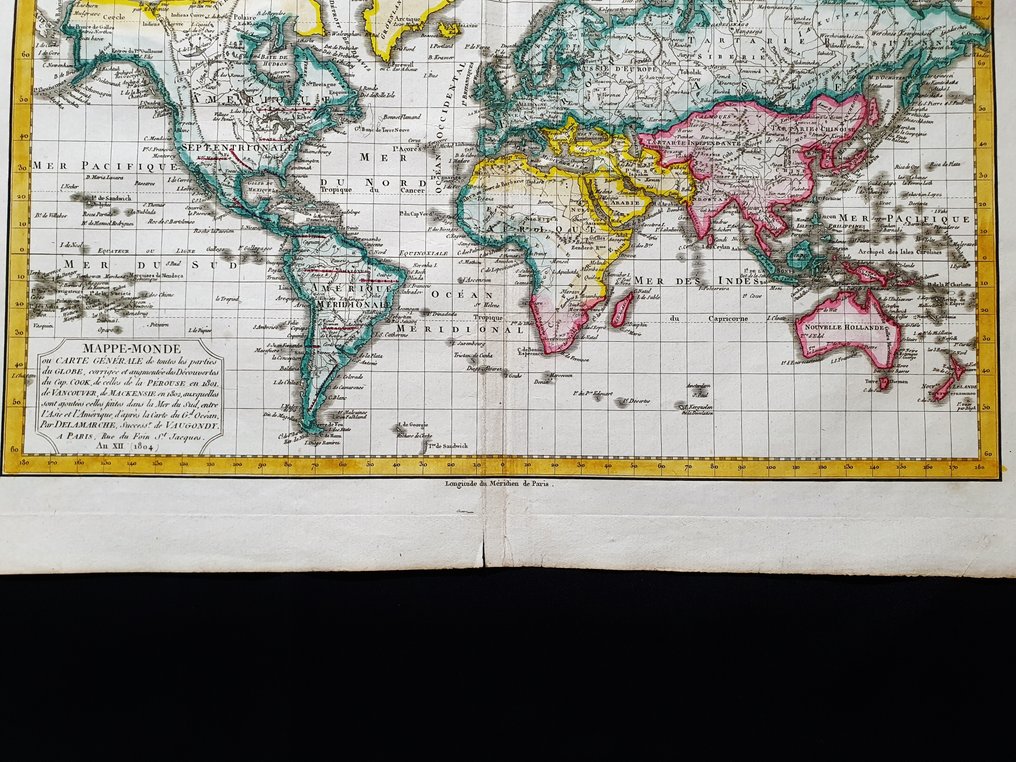
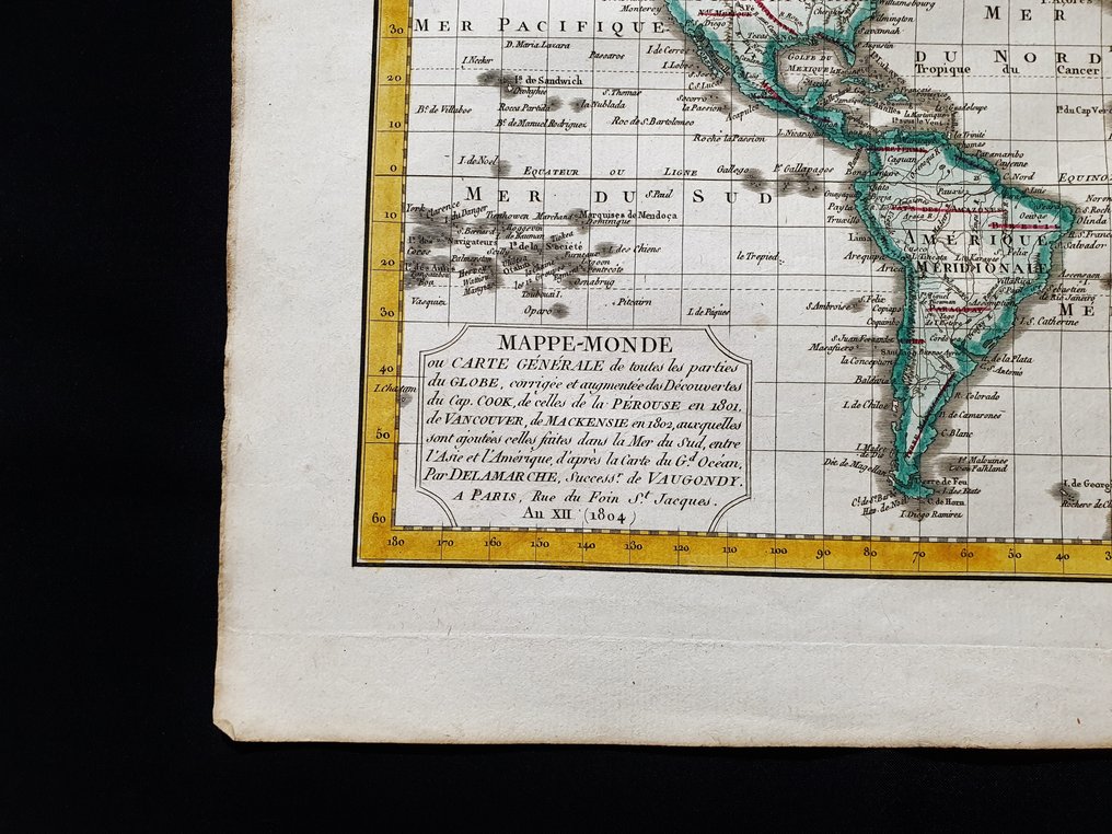
Mappamondo - World Map / Terrestrial Planisphere / Globe / Mercator's Projection; R. de Vaugondy - Masppe-Monde - 1781-1800

05
days
07
hours
22
minutes
49
seconds
Current bid
€ 35
No reserve price
9 other people are watching this object
dkBidder 6865 €35
itBidder 9039 €30
dkBidder 6865 €25

Catawiki Buyer Protection

Your payment’s safe with us until you receive your object.View details

Trustpilot 4.4 | 122473 reviews

Rated Excellent on Trustpilot.

Maspp e-Monde, copper-engraved original plate by R. de Vaugondy, Paris 1790/1805 circa edition, a World Map / Terrestrial Planisphere / Globe / Mercator's Projection in hand-coloured embossing with dimensions 45 x 33 cm, in excellent condition with very light, removable staining and scattered small cuts.

AI-assisted summary

Description from the seller

This small folio Geographical Map is an original copper engraving from around 1790/1805.

This is the edition of VAUGONDY published around 1790 / 1805 in his Atlas, which bears the name: "NOUVEL ATLAS PORTATIF Destined Mainly for the Instruction of Youth. By Robert de Vaugondy Geographer. Revised, corrected, and enlarged by C. F. Delamarche Geographer...... Paris, circa 1790 / 1805."

Map published in PARIS, with excellent coloring, wide margins, and geographically well detailed at every point.

Conditions: the conditions are more than good as shown in the photo, with some very light stains that are easily removable and a few scattered small cuts.

The overall dimensions of the map are: 45 x 33 cm

Seller's Story

I am a private Catawiki seller and I sell collectibles, a wonderful world.
Translated by Google Translate

Details

Era
1400-1900
Number of items
1
Country
Mappamondo
Geographical specification
World Map / Terrestrial Planisphere / Globe / Mercator's Projection
Map maker/ publisher
R. de Vaugondy
Map/ Book title
Masppe-Monde
Period
1781-1800
Condition
Excellent
Technique
Copper engraving
Additional Information
Original colored copper plate
Map colour
Later hand colour
Height
45 cm
Width
33 cm
ItalyVerified
8358
Objects sold
100%
Privatetop

Similar objects

For you in

Maps