Denmark - Mappa; Tobias Conrad Lotter (1717-1777) - Lobeck Tobias (notizie 1730-1750) - "Regnum Daniae" - 1721-1750


04
days
20
hours
46
minutes
45
seconds

3 other people are watching this object
 Bidder 9503 Bidder 9503 | €1 |
|---|
Catawiki Buyer Protection
Your payment’s safe with us until you receive your object.View details
Trustpilot 4.4 | 122813 reviews
Rated Excellent on Trustpilot.
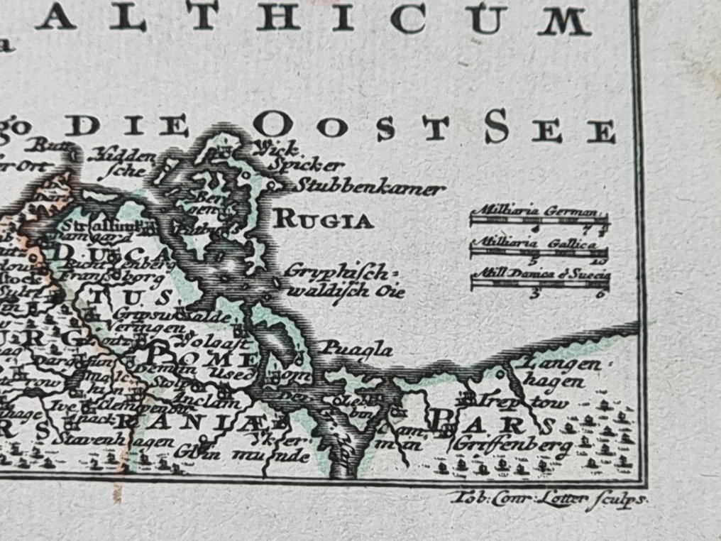
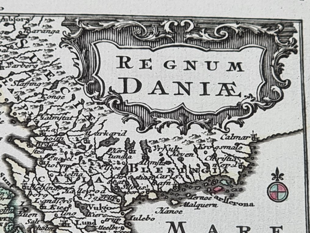
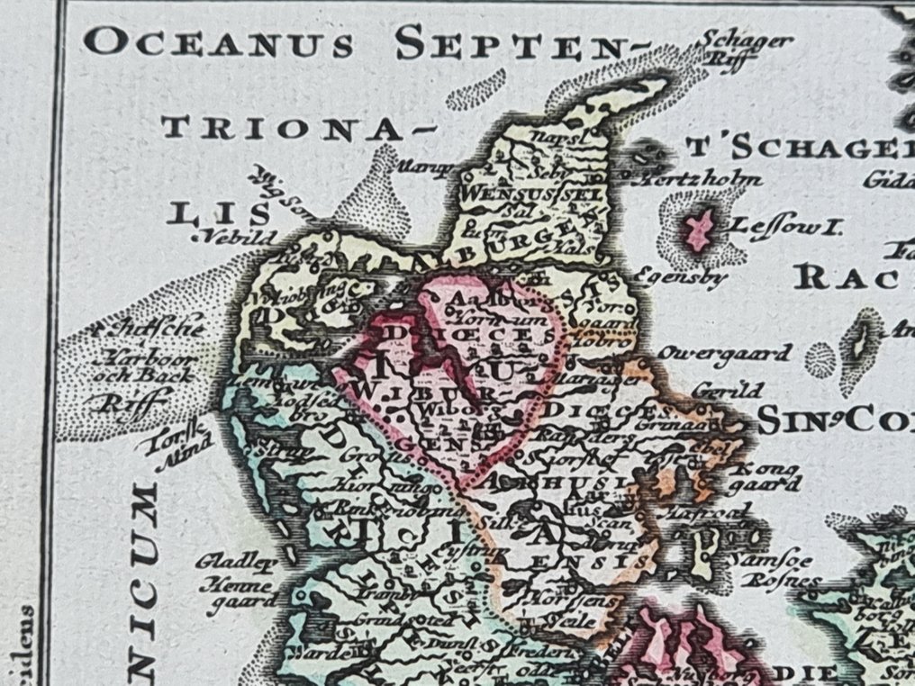
Map titled Regnum Daniae, a hand-coloured copper-engraved map by Tobias Conrad Lotter (with Lobeck Tobias), depicting Denmark, size about 110 by 140 mm, in good condition.
AI-assisted summary
Description from the seller
Finely engraved map on laid paper, contemporary coloring, excellent inking, and good preservation condition. Index table numbering at the top right in contemporary ink. Visible signs of editorial binding, slight traces of foxing and browning. Narrow margins and some small imperfections as shown in the photos. Shipped via insured courier package or rigid tube; to declare any damages at the time of pickup for insurance purposes. Provenance: private collection.
Size: approximately 110 mm x 140 mm (sheet)
Atlas Geographicus portable 29 maps of the habitable world, depicting the sky accurately. Drawn and published by Tobias Conradus Lotter in Augsburg, 1740/1770.
Lobeck Tobias (news from 1730-1750), an engraver who collaborated in the Augusta of the 18th century, about whom unfortunately not much information has survived, and Tobias Conrad Lotter (1717-1777), one of the most important German cartographic publishers of his time.
Seller's Story
The seller recommends that when collecting the shipment, you report any anomalies, damaged and/or opened packages to the courier. The insurance is not liable if these reports are not made. Thank you
Translated by Google TranslateFinely engraved map on laid paper, contemporary coloring, excellent inking, and good preservation condition. Index table numbering at the top right in contemporary ink. Visible signs of editorial binding, slight traces of foxing and browning. Narrow margins and some small imperfections as shown in the photos. Shipped via insured courier package or rigid tube; to declare any damages at the time of pickup for insurance purposes. Provenance: private collection.
Size: approximately 110 mm x 140 mm (sheet)
Atlas Geographicus portable 29 maps of the habitable world, depicting the sky accurately. Drawn and published by Tobias Conradus Lotter in Augsburg, 1740/1770.
Lobeck Tobias (news from 1730-1750), an engraver who collaborated in the Augusta of the 18th century, about whom unfortunately not much information has survived, and Tobias Conrad Lotter (1717-1777), one of the most important German cartographic publishers of his time.
Seller's Story
The seller recommends that when collecting the shipment, you report any anomalies, damaged and/or opened packages to the courier. The insurance is not liable if these reports are not made. Thank you
Translated by Google TranslateDetails
Era
1400-1900
Number of items
1
Country
Denmark
Geographical specification
Mappa
Map maker/ publisher
Tobias Conrad Lotter (1717-1777) - Lobeck Tobias (notizie 1730-1750)
Map/ Book title
"Regnum Daniae"
Period
1721-1750
Condition
Good
Technique
Copper engraving
Additional Information
Atlas Geographicus Portable 29 displaying maps of the habitable world.
Map colour
Contemporary hand colour
Height
110 mm
Width
140 mm
