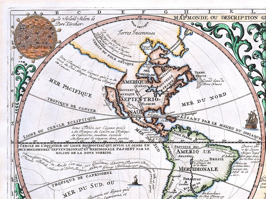
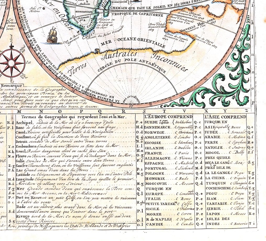
World Map - .; H. A. Chatelain - Mapmonde ou description generale du Globe Terrestre - 1701-1720

06
days
20
hours
44
minutes
03
seconds
Current bid
€ 1
No reserve price
Ilaria Colombo
Expert
Selected by Ilaria Colombo

Specialist in old books, specialising in theological disputes since 1999.

Estimate  € 150 - € 300
12 other people are watching this object
itBidder 8977 €1

Catawiki Buyer Protection

Your payment’s safe with us until you receive your object.View details

Trustpilot 4.4 | 122813 reviews

Rated Excellent on Trustpilot.

Mapmonde ou description generale du Globe Terrestre, a copper engraved world map by H. A. Chatelain, published in Amsterdam between 1701 and 1720, with later hand colour and an original antique copper engraving, sheet size 41.5 by 48 cm.

AI-assisted summary

Description from the seller

Dimensions: 33,5 x 44 cm. (on sheet: 41,5 x 48 cm.).

Condition: very good
Verso: blank.

Author: Gueudeville
Publisher: Chatelain. Amsterdam.
Note: from "Atlas historique ou Nouvelle introduction à l'histoire, à la chronologie & à la Geographie ancienne & moderne"

Henri Abraham Chatelain, whose Atlas Historique was one of the most expansive encyclopedias of the age. First published in 1705, Chatelain's Atlas Historique was part of an immense seven-volume encyclopedia. Although the main focus of the text was geography, the work also included a wealth of historical, political, and genealogical information. The text was compiled by Nicholas Gueudeville and Garillon with a supplement by H.P. de Limiers and the maps were engraved by Chatelain, primarily after charts by Delisle. Chatelain was a skilled artist and knew a combined wealth of historical and geographical information with delicate engraving and an uncomplicated composition. Groundbreaking for its time, this work included studies of geography, history, ethnology, heraldry, and cosmography. His maps with his elegant engraving are a superb example from the golden age of French mapmaking.

Details

Era
1400-1900
Country
World Map
Geographical specification
.
Map maker/ publisher
H. A. Chatelain
Map/ Book title
Mapmonde ou description generale du Globe Terrestre
Period
1701-1720
Condition
Excellent
Technique
Copper engraving
Additional Information
Original Antique Copper Engraving
Map colour
Later hand colour
Height
41.5 cm
Width
48 cm
Sold by
ItalyVerified
4391
Objects sold
100%
protop

Similar objects

For you in

Maps