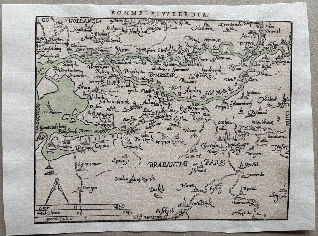
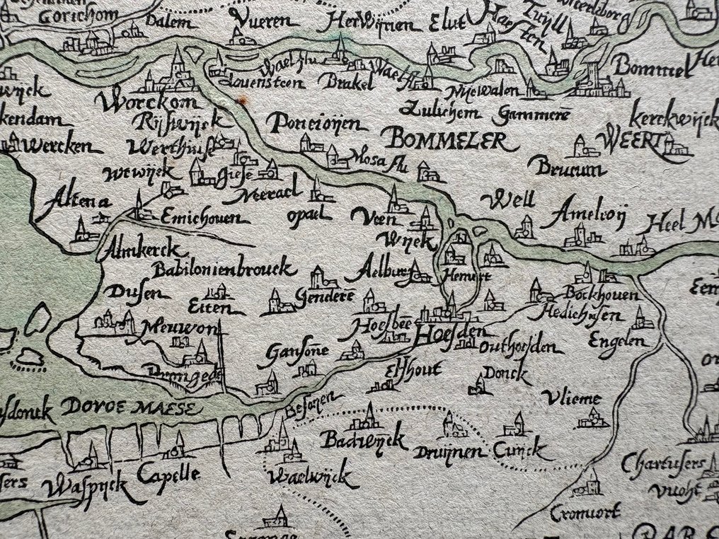
Netherlands - Bommelerwaard, Zaltbommel, part of North Brabant, 's-Hertogenbosch; Z. Heyns, naar A. Ortelius - Bommeletweerdia - 1581-1600

04
days
23
hours
28
minutes
18
seconds
Current bid
€ 1
No reserve price
4 other people are watching this object
nlBidder 3124 €1

Catawiki Buyer Protection

Your payment’s safe with us until you receive your object.View details

Trustpilot 4.4 | 122813 reviews

Rated Excellent on Trustpilot.

Dutch woodcut map Bommeletweerdia by Z. Heyns after A. Ortelius, covering the Bommelerwaard and parts of Noord-Brabant and ’s-Hertogenbosch, hand-coloured in the period, in good condition, 14.3 × 17.3 cm.

AI-assisted summary

Description from the seller

Rare and unusual map of the Bommelerwaard with part of North Brabant, by Zacharias Heyns after his edition of Ortelius' 'Epitome,' from Theatrum Orbis Terrarum.
Title in typographic font centered at the top. Shows the area from Gorcum to Kerkdriel and Dongen to Schijndel.
Here is 'Miroir du Monde,' a pocket edition by Zacharias' son Peter Heyns, Amsterdam, 1598, published as a tribute to his father. Instead of the usual copper plates from Ortelius, Peter Heyns used wood engravings. With this, he published one of the rarest small Dutch atlas productions. In 1615, a second edition was released, of which only a single copy is known (Koeman, Koninklijke Bibliotheek).
Good condition, cut at the edge of the print, mounted on sturdy paper measuring 15.3x20.9 cm, lightly colored rivers, verso text (probably) in French.

Details

Era
1400-1900
Country
Netherlands
Geographical specification
Bommelerwaard, Zaltbommel, part of North Brabant, 's-Hertogenbosch
Map maker/ publisher
Z. Heyns, naar A. Ortelius
Map/ Book title
Bommeletweerdia
Period
1581-1600
Condition
Good
Technique
Wood cut
Additional Information
Rarely encountered
Map colour
Contemporary hand colour
Height
14.3 cm
Width
17.3 cm
BelgiumVerified
403
Objects sold
100%
Privatetop

Similar objects

For you in

Maps