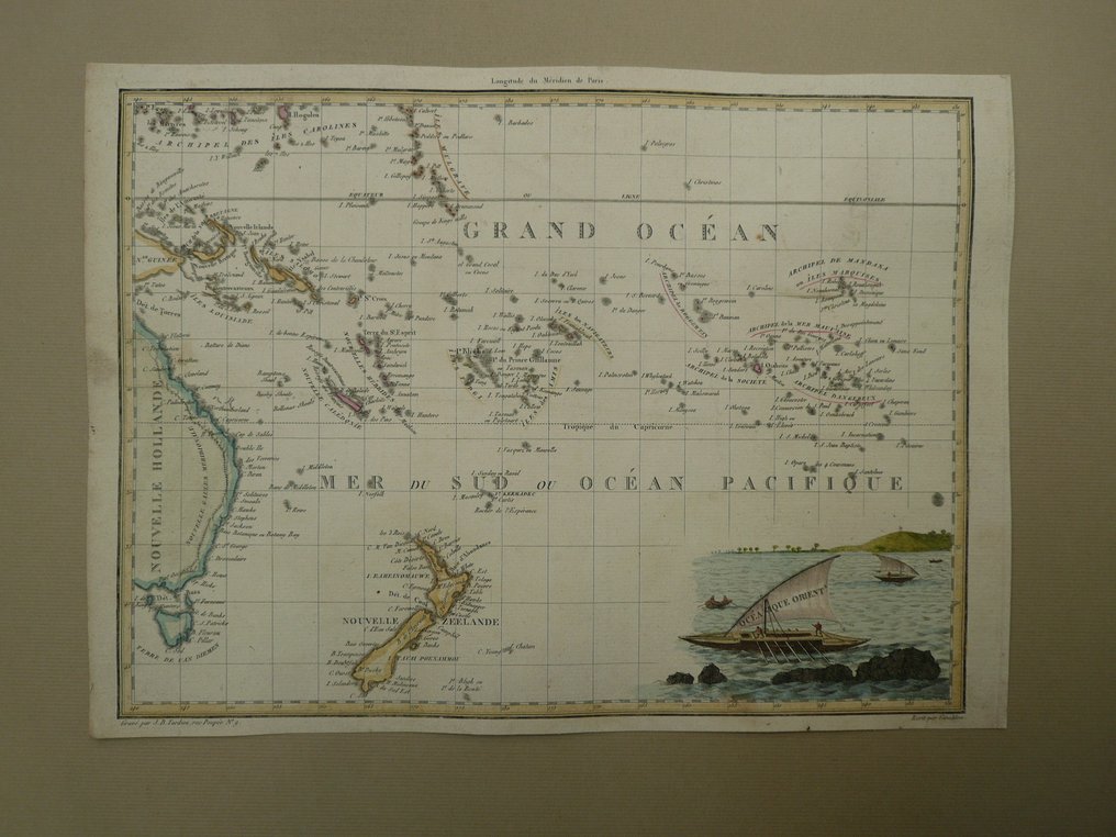
Oceania - New Zealand / Australia / Pacific; P. Lapie - Océanique Orient - 1809

00
days
15
hours
38
minutes
52
seconds
Current bid
€ 26
No reserve price
Ilaria Colombo
Expert
Selected by Ilaria Colombo

Specialist in old books, specialising in theological disputes since 1999.

Estimate  € 150 - € 200
24 other people are watching this object
deBidder 6818 €26
nlBidder 9871 €21
gbBidder 7988 €16

Catawiki Buyer Protection

Your payment’s safe with us until you receive your object.View details

Trustpilot 4.4 | 123779 reviews

Rated Excellent on Trustpilot.

Océanique Orient, a copper-engraved map by P. Lapie, published in 1809 in the Oceania region covering New Zealand, Australia and the Pacific, 22 by 30 cm, laid paper with contemporary hand colour and an attractive cartouche, in excellent condition.

AI-assisted summary

Description from the seller

Copperengraving published in; Atlas Complet Du Precis De La Geographie Universelle De M. Malte-Brun. Chez Francois Buisson, Libraire-Editeur, Rue Gilles-Coeur, No. 10. Paris, 1809.

Insured shipping.

Copperengraving published in; Atlas Complet Du Precis De La Geographie Universelle De M. Malte-Brun. Chez Francois Buisson, Libraire-Editeur, Rue Gilles-Coeur, No. 10. Paris, 1809.

Insured shipping.

Details

Era
1400-1900
Over 200 years old
Yes
Country
Oceania
Geographical specification
New Zealand / Australia / Pacific
Map maker/ publisher
P. Lapie
Map/ Book title
Océanique Orient
Period
1809
Condition
Excellent
Technique
Copper engraving
Additional Information
Beautiful cartouche. Laid paper. Old coloured.
Map colour
Contemporary hand colour
Height
22 cm
Width
30 cm
Sold by
The NetherlandsVerified
25034
Objects sold
99.82%
protop

Similar objects

For you in

Maps