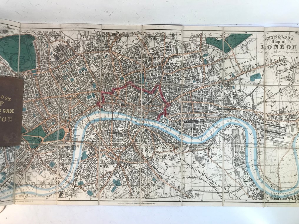
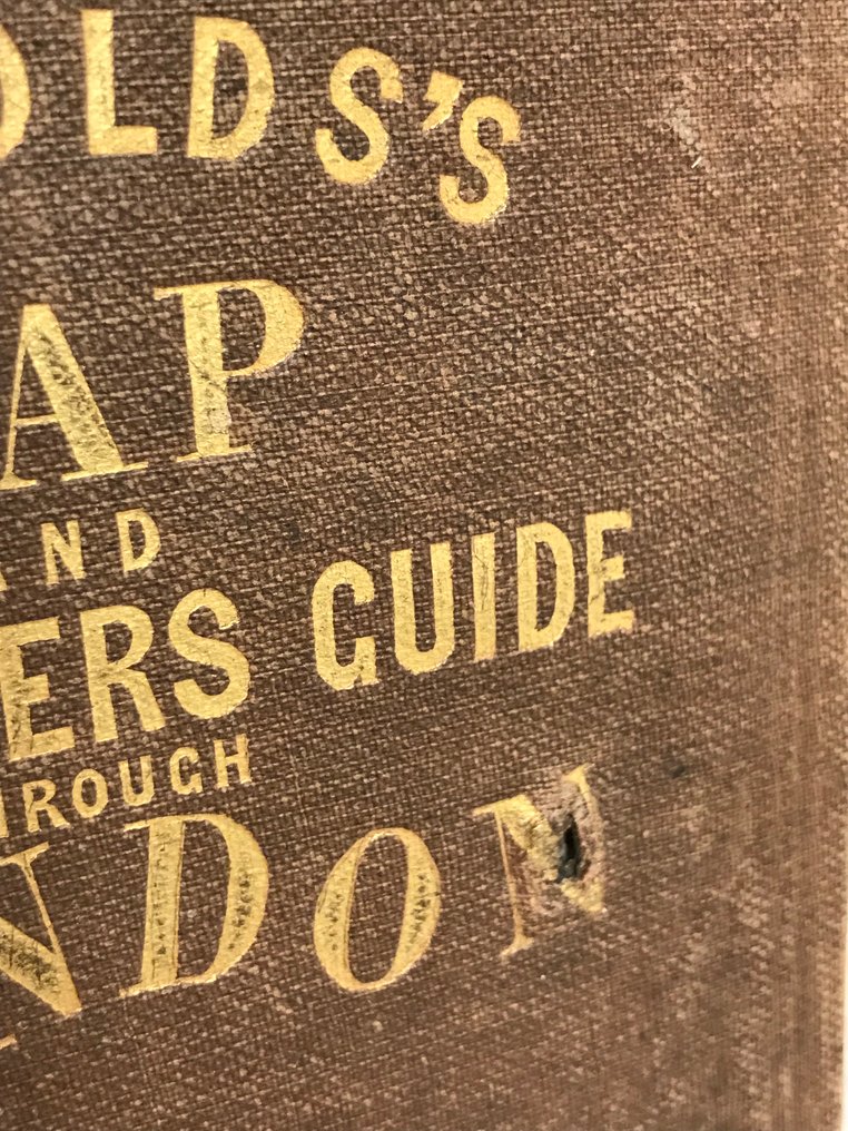
Reynold / H. Martin - Reynolds's Map and Strangers Guide Through London. - 1852

04
days
06
hours
31
minutes
43
seconds
Current bid
€ 54
No reserve price
Zena Chiara Masud
Expert
Selected by Zena Chiara Masud

Holds a master’s degree in bibliography, with seven years of experience specialising in incunabula and Arabic manuscripts.

Estimate  € 200 - € 250
13 other people are watching this object
nlBidder 0640 €54
beBidder 5867 €49
nlBidder 0640 €40

Catawiki Buyer Protection

Your payment’s safe with us until you receive your object.View details

Trustpilot 4.4 | 121980 reviews

Rated Excellent on Trustpilot.

This 1852 first edition, Reynolds's Map and Strangers Guide through London, is illustrated by H. Martin and features a hand coloured folding map of London from Hoxton to Walworth and Hyde Park to the docks.

AI-assisted summary

Description from the seller

Magnificent fold-out map of London, drawn and engraved by H. Martin, hand-colored, showing the boundaries from Hoxton in the north to Walworth in the south, and from Hyde Park in the west to the docks in the east. The map is divided into 24 sections, mounted on canvas, and folded.

Preserved in a publisher's binding in full chocolate cloth, with cold-stamped motifs at the corners and a gilt title on the front cover, with a plain spine.

Lower plate edges are unpolished, with worn caps and corners, the first plate has a small hole. A few notes in ink on the back of the card. Slightly yellowed paper, card in very good condition.

Without the London guide.

Reynolds’s Map and Strangers Guide through London
London, published by J. Reynolds, 174 Strand, 1852
Coated and folded card, enhanced with color.
in-12 (15x10.5cm); Dimensions of the unfolded card: 780 x 428 mm.

Seller's Story

We are looking for old books for our bibliophile customers. We currently have a strong demand on the web. On-site withdrawals are only from MONDAY TO FRIDAY, from 9 a.m. to 4 p.m. Passage Bookstore - Gribaudo Vandamme Bookstore 48-62 Passage Jouffroy - 75009 Paris
Translated by Google Translate

Details

Number of Books
1
Subject
Travels
Book Title
Reynolds's Map and Strangers Guide Through London.
Author/ Illustrator
Reynold / H. Martin
Condition
Good
Publication year oldest item
1852
Edition
1st Edition
Language
English
Original language
Yes
Number of pages
1
FranceVerified
32809
Objects sold
99.45%
protop

Similar objects

For you in

Books