10 British army Trench maps, Belgie, Frankrijk - 1901-1920


06
days
09
hours
01
minute
31
seconds
Current bid
€ 39
No reserve price

Expert
Selected by Marcel van Hulst
Over 35 years trading and collecting militaria with deep industry knowledge.
Estimate € 180 - € 250
17 other people are watching this object
 Bidder 9541 Bidder 9541 | €39 | |
|---|---|---|
| Bidder 5316 | €30 | |
| Bidder 9541 | €25 | |
Catawiki Buyer Protection
Your payment’s safe with us until you receive your object.View details
Trustpilot 4.4 | 122028 reviews
Rated Excellent on Trustpilot.
Ten British Army trench maps of Belgium and France, dating from 1901–1920, printed in colour, with overall dimensions 100 cm by 100 cm, in good condition.
AI-assisted summary
Description from the seller
10 military maps: 9 trench maps and 1 old military map of Roulers (Roeselare).
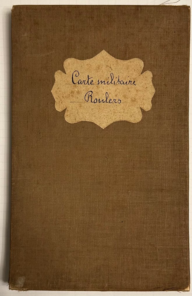
1. Roulers military map, surveyed and leveled in 1860 and 1861. Drafted and engraved at the war depot in Brussels in 1885.
Equidistance of 5 meters. 87cm x 58 cm scale 1:40.00
This card is in reasonable condition with signs of aging and small tears in the folds.
2. Trench map Belgium and France sheet SHEET 19 S.E. second edition in Belgium 20 S.W. Edition 5.A.
Trenches corrected to 17.10.17
164 cm x 157 cm scale 1:20,000
Very large double map in good condition but showing signs of use and aging, with small tears at the folds. Likely hand-colored and supplemented with place names.
3. Trench map of the SAS 20S.W. 3 & 4 (parts of). Edition 1. A
Trenches corrected to 30.6.17
68cm x 92cm scale 1:10,000
Card in good condition with normal signs of aging without tears.
4. Trench map Belgium sheet 20 S.W. edition 5. A
Trenches corrected to 17.10.17
66cm x 90cm scale 1:20,000
Card in good condition with signs of aging without tears.
5. France ('B' series) sheet 27A S.E. first edition (Revised system of squaring)
manual inscription in black ink 'Saint Omer' and in red pencil 'Army training area'.
90cm x 68cm scale 1:20,000
In good condition with signs of aging without tears.
6. Trench map Belgium & France sheet 28 S.E. edition 3. The map has a handwritten inscription in black ink: 'Comines Wervicq Halluin'.
Trenches corrected as of 10.6.16.
65cm x 90cm scale 1:20,000
In good condition with signs of aging without tears.
7. Trench map Belgium sheet 28. N.W. edition 6. An illegible manual inscription in black pencil.
Trenches corrected to 30.6.17
65cm x 90cm scale 1:20,000
In good condition with signs of aging without tears.
8. Trench map Belgium and France sheet 28 S.W. edition 3. The map has a handwritten inscription in black ink: 'Westouine Hollebeek Bailleul Deutemont.'
Trenches corrected to 22.6.16
65cm x 90cm scale 1:20,000
In good condition with signs of aging without tears.
9. Trench map France sheet 36 N.E. edition 6. B with manual inscription in black ink "Quesnoy Roubaix Tourcoing La Madeleine (Lille)"
Trenches corrected to 1.5.16
68cm x 90cm scale 1:20,000
In good condition with signs of aging without tears.
10. Trench map France sheet 36 S.W. edition 7. A handwritten inscription in black ink: 'Laventie, Neuve-Chapelle, Richebourg.'
Trenches corrected to 9.6.16.
66cm x 83cm scale 1:20,000
In good condition with signs of aging, a small right strip has been cut off at the edge of the card, but the card itself appears to be completely intact.
10 military maps: 9 trench maps and 1 old military map of Roulers (Roeselare).
1. Roulers military map, surveyed and leveled in 1860 and 1861. Drafted and engraved at the war depot in Brussels in 1885.
Equidistance of 5 meters. 87cm x 58 cm scale 1:40.00
This card is in reasonable condition with signs of aging and small tears in the folds.
2. Trench map Belgium and France sheet SHEET 19 S.E. second edition in Belgium 20 S.W. Edition 5.A.
Trenches corrected to 17.10.17
164 cm x 157 cm scale 1:20,000
Very large double map in good condition but showing signs of use and aging, with small tears at the folds. Likely hand-colored and supplemented with place names.
3. Trench map of the SAS 20S.W. 3 & 4 (parts of). Edition 1. A
Trenches corrected to 30.6.17
68cm x 92cm scale 1:10,000
Card in good condition with normal signs of aging without tears.
4. Trench map Belgium sheet 20 S.W. edition 5. A
Trenches corrected to 17.10.17
66cm x 90cm scale 1:20,000
Card in good condition with signs of aging without tears.
5. France ('B' series) sheet 27A S.E. first edition (Revised system of squaring)
manual inscription in black ink 'Saint Omer' and in red pencil 'Army training area'.
90cm x 68cm scale 1:20,000
In good condition with signs of aging without tears.
6. Trench map Belgium & France sheet 28 S.E. edition 3. The map has a handwritten inscription in black ink: 'Comines Wervicq Halluin'.
Trenches corrected as of 10.6.16.
65cm x 90cm scale 1:20,000
In good condition with signs of aging without tears.
7. Trench map Belgium sheet 28. N.W. edition 6. An illegible manual inscription in black pencil.
Trenches corrected to 30.6.17
65cm x 90cm scale 1:20,000
In good condition with signs of aging without tears.
8. Trench map Belgium and France sheet 28 S.W. edition 3. The map has a handwritten inscription in black ink: 'Westouine Hollebeek Bailleul Deutemont.'
Trenches corrected to 22.6.16
65cm x 90cm scale 1:20,000
In good condition with signs of aging without tears.
9. Trench map France sheet 36 N.E. edition 6. B with manual inscription in black ink "Quesnoy Roubaix Tourcoing La Madeleine (Lille)"
Trenches corrected to 1.5.16
68cm x 90cm scale 1:20,000
In good condition with signs of aging without tears.
10. Trench map France sheet 36 S.W. edition 7. A handwritten inscription in black ink: 'Laventie, Neuve-Chapelle, Richebourg.'
Trenches corrected to 9.6.16.
66cm x 83cm scale 1:20,000
In good condition with signs of aging, a small right strip has been cut off at the edge of the card, but the card itself appears to be completely intact.
Details
Era
1900-2000
Number of items
10
Map/ Book title
10 British army Trench maps, Belgie, Frankrijk
Period
1901-1920
Condition
Good
Additional Information
Authentic trench maps of the British army.
Map colour
Printed in colour
Height
100 cm
Width
100 cm
Sold by