E. Cortambert - Atlas de géographie moderne - 1886


Starting bid
€ 1
Add to your favourites to get an alert when the auction starts.

Catawiki Buyer Protection
Your payment’s safe with us until you receive your object.View details
Trustpilot 4.4 | 139803 reviews
Rated Excellent on Trustpilot.
Description from the seller
Stunning illustrated edition of 66 maps from this comprehensive cartographic collection, offering a detailed and up-to-date view of the world in the 19th century, combining scientific rigor with pedagogical clarity -
The atlas features political, physical, economic, and thematic maps, illustrating population distribution, natural resources, transportation routes, as well as the borders and administrative divisions of the various countries and continents -
Cortambert emphasizes topographic precision and readability of the maps, incorporating explanatory legends, scales, and standardized symbols to facilitate the understanding of geographic phenomena -
The work also includes observations on climate, geology, and urban planning, as well as historical maps allowing the positioning of the evolution of territories and civilizations over time -
Intended for a school and university audience, the atlas combines pedagogy and erudition, offering a tool that is both practical and instructive for the study of modern geography and international relations -
E. Cortambert - Atlas de géographie moderne - 1886 - Hachette et Cie -
66 color maps
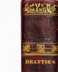
Good binding; the volume in its original red half-binding with corners, wear from use, ink stains at the bottom of the boards, worn headpieces, speckled edges, smooth spine ornamented, title and author’s name gilded, gilt lines on the boards -
Good interior condition, browning, the work enriched with 66 color maps out of text including on double-page spreads and folding plates, blue endpapers in good condition -
Delivery service available within a few days –
Stunning illustrated edition of 66 maps from this comprehensive cartographic collection, offering a detailed and up-to-date view of the world in the 19th century, combining scientific rigor with pedagogical clarity -
The atlas features political, physical, economic, and thematic maps, illustrating population distribution, natural resources, transportation routes, as well as the borders and administrative divisions of the various countries and continents -
Cortambert emphasizes topographic precision and readability of the maps, incorporating explanatory legends, scales, and standardized symbols to facilitate the understanding of geographic phenomena -
The work also includes observations on climate, geology, and urban planning, as well as historical maps allowing the positioning of the evolution of territories and civilizations over time -
Intended for a school and university audience, the atlas combines pedagogy and erudition, offering a tool that is both practical and instructive for the study of modern geography and international relations -
E. Cortambert - Atlas de géographie moderne - 1886 - Hachette et Cie -
66 color maps
Good binding; the volume in its original red half-binding with corners, wear from use, ink stains at the bottom of the boards, worn headpieces, speckled edges, smooth spine ornamented, title and author’s name gilded, gilt lines on the boards -
Good interior condition, browning, the work enriched with 66 color maps out of text including on double-page spreads and folding plates, blue endpapers in good condition -
Delivery service available within a few days –
Details
Number of books
1
Subject
Cartography, Geography, History, Illustrated
Book title
Atlas de géographie moderne
Author/ Illustrator
E. Cortambert
Condition
Good
Publication year oldest item
1886
Edition
Illustrated Edition
Language
French
Original language
Yes
Publisher
Hachette et Cie
Binding/ Material
Hardback
Number of pages
66