Vosgien & Laurent Echard - Dictionnaire géographique portatif, ou description des royaumes, provinces, villes, évêchés - 1801


09
days
19
hours
19
minutes
38
seconds

No bids placed
Catawiki Buyer Protection
Your payment’s safe with us until you receive your object.View details
Trustpilot 4.4 | 142857 reviews
Rated Excellent on Trustpilot.
Dictionnaire géographique portatif, or description of kingdoms, provinces, cities, and bishoprics by Vosgien & Laurent Echard, published by Delalain in 1801, a 1014-page illustrated demi‑leather binding in French with two folding geographical maps, in good interior and exterior condition.
AI-assisted summary
Description from the seller
An enthralling illustrated edition with 2 geographical maps on folding plates (maps: world map, Europe, Map of France) of this descriptive geography work intended to offer, in a practical and easily consultable form, a general knowledge of the main territories, cities and political and religious divisions of the known world at the time of its publication -
With its alphabetical design, the dictionary serves a primarily educational and documentary aim, allowing the reader to quickly find the name of a kingdom, province, city, diocese or another notable place and to obtain its main geographical, administrative, historical and sometimes economic information -
The work belongs to a long tradition of portable geographical dictionaries that emerged in the 18th century, at a time when the growth of trade, travel, diplomatic relations and cartographic knowledge made it necessary to provide works capable of condensing a considerable volume of information -
Laurent Eschard / Vosgien - Portable Geographical Dictionary, or Description of the Kingdoms, Provinces, Cities, Dioceses - 1801 - Delalain - 1014 Pages.
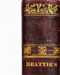
Condition: good binding; the book is in its original half brown calf, marbled boards, wear from use, some minor defects on covers and spine (spine damaged), cracks on the head, endbands cracked, worn boards, speckled edges, smooth spine ornate, gold lettering on a green morocco label -
Good interior condition, some stains with moisture trace, text in two columns, book enriched with 2 geographical maps on folding plates (maps: world map, Europe, Map of France), modern endpapers in fair condition, ex-libris, a good copy -
Delivery service guaranteed within a few days –
An enthralling illustrated edition with 2 geographical maps on folding plates (maps: world map, Europe, Map of France) of this descriptive geography work intended to offer, in a practical and easily consultable form, a general knowledge of the main territories, cities and political and religious divisions of the known world at the time of its publication -
With its alphabetical design, the dictionary serves a primarily educational and documentary aim, allowing the reader to quickly find the name of a kingdom, province, city, diocese or another notable place and to obtain its main geographical, administrative, historical and sometimes economic information -
The work belongs to a long tradition of portable geographical dictionaries that emerged in the 18th century, at a time when the growth of trade, travel, diplomatic relations and cartographic knowledge made it necessary to provide works capable of condensing a considerable volume of information -
Laurent Eschard / Vosgien - Portable Geographical Dictionary, or Description of the Kingdoms, Provinces, Cities, Dioceses - 1801 - Delalain - 1014 Pages.
Condition: good binding; the book is in its original half brown calf, marbled boards, wear from use, some minor defects on covers and spine (spine damaged), cracks on the head, endbands cracked, worn boards, speckled edges, smooth spine ornate, gold lettering on a green morocco label -
Good interior condition, some stains with moisture trace, text in two columns, book enriched with 2 geographical maps on folding plates (maps: world map, Europe, Map of France), modern endpapers in fair condition, ex-libris, a good copy -
Delivery service guaranteed within a few days –
Details
Number of books
1
Subject
Cartography, Dictionaries and thesauri, Geography, History, Illustrated, Politics, Reference
Book title
Dictionnaire géographique portatif, ou description des royaumes, provinces, villes, évêchés
Author/ Illustrator
Vosgien & Laurent Echard
Condition
Good
Publication year oldest item
1801
Height
20 cm
Edition
Illustrated Edition
Width
13 cm
Language
French
Original language
No
Publisher
Delalain
Binding/ Material
Half leather
Number of pages
1014