Heylyn - Cosmographie - 1669


13
days
14
hours
35
minutes
46
seconds
Current bid
€ 100
Reserve price not met

Expert
Selected by Ilaria Colombo
Specialist in old books, specialising in theological disputes since 1999.
Estimate € 1,300 - € 3,000
 | €100 |
|---|
Catawiki Buyer Protection
Your payment’s safe with us until you receive your object.View details
Trustpilot 4.4 | 143539 reviews
Rated Excellent on Trustpilot.
Cosmographie by Peter Heylyn, the illustrated 1st edition in this format published in London by Anne Seile in 1669, a single volume on geography in English with original language, bound in leather, measuring 348 × 235 mm and containing 954 pages.
AI-assisted summary
Description from the seller
[Please note that the background setting in some images was created using AI to present the books in a pleasant environment. These background elements do not alter or affect the true representation and condition of the books]
THE NEW WORLD BETWEEN COLONIES AND EMPIRE: AMERICAS INVENTED IN THE 1669 COSMOGRAPHY
Very interesting is the map of North America, where Mexico is above New England. Fascinating, imprecise and yet to be defined.
Edition of 1669 of Peter Heylyn's Cosmography, one of the most articulated geographic syntheses of seventeenth-century English thought, here reread with particular attention to the representation of the Americas. In this work, the New World emerges as a central space in the construction of European geographic knowledge, not only described but interpreted according to a political, religious, and cultural logic. Heylyn presents an America still in formation, traversed by colonial dynamics, confessional conflicts, and processes of territorial appropriation. The Cosmography thus configures itself as a tool for reading and organizing the world, in which the Americas assume a decisive role in redefining global balances.
WHY TO BUY
THE NEW WORLD IN 1669 – A grand seventeenth-century cosmography that documents how Europe represented and interpreted the Americas during the age of colonial expansion.
AN AMERICA STILL TO BE DRAWN – Particularly fascinating is the North American map, with geographies that seem surprising today and Mexico placed above New England.
FOUR GREAT GEOGRAPHIC MAPS – The cartographic apparatus offers a vivid visual testimony of a world still incompletely known and continually redefined.
GEOGRAPHY, POWER AND EMPIRE – Heylyn does not merely describe territories: he tells the new global order of the seventeenth century, between explorations, colonization, religion, and competition among European powers.
MARKET VALUE
Complete copies generally range between €2,500 and €3,500; well-preserved copies can exceed €4,000.
PHYSICAL DESCRIPTION AND CONDITION
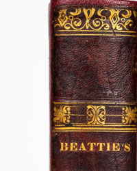
Contemporary full leather binding with raised spine, signs of wear on hinges and boards. Red and black typographic title-page and an additional allegorical engraved title-page signed J. Fillan, with edges restored; both with stains and signs of use. Text laid out in two columns.
Initial imprimatur leaf bound at the end of the Preface. Binding errors: fascicles 2C2 and 3 inverted. Small gap on leaf [3]K3 with loss of some letters. The white leaf [4]V6 is present.
Brunettes and physiological foxing. The four large geographic maps have been extracted and mounted on modern card stock: they show some gaps.
In old books, with a long history, there may be imperfections not always noted in the description.
Collation: pp. 14 nn.; 272; 4 nn.; 226; 2 nn.; 230; 2 nn.; 162; 40 nn.; (2).
FULL TITLE AND AUTHOR
Cosmography in Four Books containing the Chorography and Historie of the Whole World, and all the Principal Kingdoms, Provinces, Seas and Isles thereof.
London, Anne Seile, 1669.
Peter Heylyn.
CONTEXT AND SIGNIFICANCE
Very interesting is the map of North America, where Mexico is above New England. Fascinating, imprecise and little defined.
In Heylyn's geographic system, the Americas occupy a strategic and symbolic position. It is not merely distant territories, but a space where Europe’s political and religious ambitions of the seventeenth century are projected.
The American continent is described through a double lens: on one hand as a geographical reality to classify and order, on the other as a theater of colonial expansion. Heylyn interprets the Americas according to an implicit hierarchy that reflects European centrality, placing the New World within a global framework dominated by England and Western powers.
The distinction between Chorography and History assumes here a particular meaning: the Americas are not only places, but evolving stories, territories whose identity is built through conquests, explorations, and conflicts. Geography thus becomes a tool of intellectual and symbolic control, capable of turning space into narrative and territory into domination.
In this sense, the Cosmography is not merely a descriptive work, but an ideological device that contributes to the construction of the European imaginary of the Americas.
BIOGRAPHY OF THE AUTHOR
Peter Heylyn (1599–1662) was an English clergyman, historian, and geographer, educated at Oxford. A supporter of the monarchy and the Anglican Church, he developed a profoundly hierarchical and orderly worldview.
His Cosmography represents an attempt to organize geographic knowledge into a systematic form, integrating territorial description and historical interpretation according to a European and confessional perspective.
PRINTING HISTORY AND CIRCULATION
Cosmography was first published in 1652 and went through numerous reprintings. The 1669 edition, fifth, represents an advanced phase of the publishing project.
Printed for Anne Seile and other London booksellers, it testifies to the maturity of English book production in the seventeenth century and the growing demand for geographic works aimed at a cultured audience interested in the global dimension.
BIBLIOGRAPHY AND REFERENCES
ESTC R18329.
Wing, Donald G., Short-Title Catalogue of Books Printed in England, Scotland, Ireland 1641–1700, H1692A.
British Library Catalogue, Heylyn, Cosmographie, edizione 1669.
Shirley, Rodney W., The Mapping of the World: Early Printed World Maps 1472–1700, London, 1983, pp. 430–435.
Burden, Philip D., The Mapping of North America: A List of Printed Maps 1511–1670, London, 1996, pp. 350–360.
Tooley, Ronald V., Maps and Map-makers, London, 1978, pp. 90–95.
WorldCat/OCLC, census of the 1669 edition in international libraries.
Seller's Story
Luxury Books: Your Go-To Guide for Nabbing Literary Treasures!
Embarking on the thrilling journey of collecting rare and timeless printed works? Here's your snappy rundown, "The Collector's Cheat Sheet," to ensure you're not just flipping pages but stacking up the value:
1. Edition and Rarity: Rarity is the name of the game. First editions, limited printings, and books flaunting unique features like eye-catching illustrations or mind-blowing bindings? Consider them the VIPs of the collector's world.
2. Condition & Dimension: Picture this – a book in mint condition, untouched by the woes of wear and tear. Now, flip the script: wear, foxing, discoloration – they're the villains here. And don't forget to size up the dimensions, because a book's size matters in the collector's universe.
3. Authenticity: In a world of replicas and forgeries, verifying a book's authenticity is your superhero move. Expert examination and authentication – your trusty sidekicks in this quest.
4. Provenance: Who owned it before you? If the book has hobnobbed with famous figures or danced through historical events, its value skyrockets. Every book has a story, but some have blockbuster tales.
5. Demand and Market Trends: Think of book values as the stock market of the literary world. Stay savvy on collector trends and market shifts to ride the waves of value.
6. Subject Matter: Some topics are like fine wine – they get better with time. Dive into subjects with a timeless appeal or ride the wave of emerging cultural and historical relevance.
7. Binding and Design: Beauty is more than skin deep. Intricate bindings, stunning covers, and illustrations – these are the accessories that make a book runway-ready in the collector's eyes.
8. Association Copies: Books with a personal touch – whether it's a connection to the author or a famous personality – elevate the historical vibes. A book with a backstory? Count us in.
9. Investment Potential: Passion is the engine, but some collectors eye future returns. Keep in mind, though, that the book market can be as unpredictable as a plot twist.
10. Expert Advice: New to the game? Don't play solo. Seek wisdom from the book gurus, hit up book fairs, and join collector communities. We at Luxury Books are the Yodas of the rare book galaxy, helping you build collections that scream sophistication and cultural clout.
Because collecting rare books isn't just about dollar signs – it's a journey of preserving heritage and embracing literary treasures. Happy collecting!
Translated by Google Translate[Please note that the background setting in some images was created using AI to present the books in a pleasant environment. These background elements do not alter or affect the true representation and condition of the books]
THE NEW WORLD BETWEEN COLONIES AND EMPIRE: AMERICAS INVENTED IN THE 1669 COSMOGRAPHY
Very interesting is the map of North America, where Mexico is above New England. Fascinating, imprecise and yet to be defined.
Edition of 1669 of Peter Heylyn's Cosmography, one of the most articulated geographic syntheses of seventeenth-century English thought, here reread with particular attention to the representation of the Americas. In this work, the New World emerges as a central space in the construction of European geographic knowledge, not only described but interpreted according to a political, religious, and cultural logic. Heylyn presents an America still in formation, traversed by colonial dynamics, confessional conflicts, and processes of territorial appropriation. The Cosmography thus configures itself as a tool for reading and organizing the world, in which the Americas assume a decisive role in redefining global balances.
WHY TO BUY
THE NEW WORLD IN 1669 – A grand seventeenth-century cosmography that documents how Europe represented and interpreted the Americas during the age of colonial expansion.
AN AMERICA STILL TO BE DRAWN – Particularly fascinating is the North American map, with geographies that seem surprising today and Mexico placed above New England.
FOUR GREAT GEOGRAPHIC MAPS – The cartographic apparatus offers a vivid visual testimony of a world still incompletely known and continually redefined.
GEOGRAPHY, POWER AND EMPIRE – Heylyn does not merely describe territories: he tells the new global order of the seventeenth century, between explorations, colonization, religion, and competition among European powers.
MARKET VALUE
Complete copies generally range between €2,500 and €3,500; well-preserved copies can exceed €4,000.
PHYSICAL DESCRIPTION AND CONDITION
Contemporary full leather binding with raised spine, signs of wear on hinges and boards. Red and black typographic title-page and an additional allegorical engraved title-page signed J. Fillan, with edges restored; both with stains and signs of use. Text laid out in two columns.
Initial imprimatur leaf bound at the end of the Preface. Binding errors: fascicles 2C2 and 3 inverted. Small gap on leaf [3]K3 with loss of some letters. The white leaf [4]V6 is present.
Brunettes and physiological foxing. The four large geographic maps have been extracted and mounted on modern card stock: they show some gaps.
In old books, with a long history, there may be imperfections not always noted in the description.
Collation: pp. 14 nn.; 272; 4 nn.; 226; 2 nn.; 230; 2 nn.; 162; 40 nn.; (2).
FULL TITLE AND AUTHOR
Cosmography in Four Books containing the Chorography and Historie of the Whole World, and all the Principal Kingdoms, Provinces, Seas and Isles thereof.
London, Anne Seile, 1669.
Peter Heylyn.
CONTEXT AND SIGNIFICANCE
Very interesting is the map of North America, where Mexico is above New England. Fascinating, imprecise and little defined.
In Heylyn's geographic system, the Americas occupy a strategic and symbolic position. It is not merely distant territories, but a space where Europe’s political and religious ambitions of the seventeenth century are projected.
The American continent is described through a double lens: on one hand as a geographical reality to classify and order, on the other as a theater of colonial expansion. Heylyn interprets the Americas according to an implicit hierarchy that reflects European centrality, placing the New World within a global framework dominated by England and Western powers.
The distinction between Chorography and History assumes here a particular meaning: the Americas are not only places, but evolving stories, territories whose identity is built through conquests, explorations, and conflicts. Geography thus becomes a tool of intellectual and symbolic control, capable of turning space into narrative and territory into domination.
In this sense, the Cosmography is not merely a descriptive work, but an ideological device that contributes to the construction of the European imaginary of the Americas.
BIOGRAPHY OF THE AUTHOR
Peter Heylyn (1599–1662) was an English clergyman, historian, and geographer, educated at Oxford. A supporter of the monarchy and the Anglican Church, he developed a profoundly hierarchical and orderly worldview.
His Cosmography represents an attempt to organize geographic knowledge into a systematic form, integrating territorial description and historical interpretation according to a European and confessional perspective.
PRINTING HISTORY AND CIRCULATION
Cosmography was first published in 1652 and went through numerous reprintings. The 1669 edition, fifth, represents an advanced phase of the publishing project.
Printed for Anne Seile and other London booksellers, it testifies to the maturity of English book production in the seventeenth century and the growing demand for geographic works aimed at a cultured audience interested in the global dimension.
BIBLIOGRAPHY AND REFERENCES
ESTC R18329.
Wing, Donald G., Short-Title Catalogue of Books Printed in England, Scotland, Ireland 1641–1700, H1692A.
British Library Catalogue, Heylyn, Cosmographie, edizione 1669.
Shirley, Rodney W., The Mapping of the World: Early Printed World Maps 1472–1700, London, 1983, pp. 430–435.
Burden, Philip D., The Mapping of North America: A List of Printed Maps 1511–1670, London, 1996, pp. 350–360.
Tooley, Ronald V., Maps and Map-makers, London, 1978, pp. 90–95.
WorldCat/OCLC, census of the 1669 edition in international libraries.
Seller's Story
Luxury Books: Your Go-To Guide for Nabbing Literary Treasures!
Embarking on the thrilling journey of collecting rare and timeless printed works? Here's your snappy rundown, "The Collector's Cheat Sheet," to ensure you're not just flipping pages but stacking up the value:
1. Edition and Rarity: Rarity is the name of the game. First editions, limited printings, and books flaunting unique features like eye-catching illustrations or mind-blowing bindings? Consider them the VIPs of the collector's world.
2. Condition & Dimension: Picture this – a book in mint condition, untouched by the woes of wear and tear. Now, flip the script: wear, foxing, discoloration – they're the villains here. And don't forget to size up the dimensions, because a book's size matters in the collector's universe.
3. Authenticity: In a world of replicas and forgeries, verifying a book's authenticity is your superhero move. Expert examination and authentication – your trusty sidekicks in this quest.
4. Provenance: Who owned it before you? If the book has hobnobbed with famous figures or danced through historical events, its value skyrockets. Every book has a story, but some have blockbuster tales.
5. Demand and Market Trends: Think of book values as the stock market of the literary world. Stay savvy on collector trends and market shifts to ride the waves of value.
6. Subject Matter: Some topics are like fine wine – they get better with time. Dive into subjects with a timeless appeal or ride the wave of emerging cultural and historical relevance.
7. Binding and Design: Beauty is more than skin deep. Intricate bindings, stunning covers, and illustrations – these are the accessories that make a book runway-ready in the collector's eyes.
8. Association Copies: Books with a personal touch – whether it's a connection to the author or a famous personality – elevate the historical vibes. A book with a backstory? Count us in.
9. Investment Potential: Passion is the engine, but some collectors eye future returns. Keep in mind, though, that the book market can be as unpredictable as a plot twist.
10. Expert Advice: New to the game? Don't play solo. Seek wisdom from the book gurus, hit up book fairs, and join collector communities. We at Luxury Books are the Yodas of the rare book galaxy, helping you build collections that scream sophistication and cultural clout.
Because collecting rare books isn't just about dollar signs – it's a journey of preserving heritage and embracing literary treasures. Happy collecting!
Translated by Google TranslateDetails
Number of books
1
Subject
Geography, History
Book title
Cosmographie
Author/ Illustrator
Heylyn
Condition
Good
Publication year oldest item
1669
Height
348 mm
Edition
1st Edition Thus, Illustrated Edition
Width
235 mm
Language
English
Original language
Yes
Publisher
London, Anne Seile, 1669
Binding/ Material
Leather
Extras
Tipped in plates
Number of pages
954
Sold by