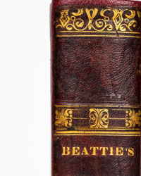
Guida d'Italia - Albania - 1940


Starting bid
€ 1
Add to your favourites to get an alert when the auction starts.

Catawiki Buyer Protection
Your payment’s safe with us until you receive your object.View details
Trustpilot 4.4 | 145217 reviews
Rated Excellent on Trustpilot.
Description from the seller
Volume - first limited edition - belongs to one of the most prestigious cartographic and documentary series of early 20th-century Italy. Its publication falls within a precise and dramatic historical moment, in 1940, when Albania was under the occupation of the Italian crown (which had occurred in 1939). This manual was not born as a simple pleasure guide, but as an institutional and logistical operation tied to Italian geopolitical expansion in the Balkans. The volume was produced in collaboration with the Under-Secretariat of State for Albanian Affairs, with the strategic objective of census, mapping, and making the territory known to both military troops and Italian technicians sent to the field.
The work is renowned for the immense precision of its scientific data and for its extraordinary cartographic apparatus. The seven geographical maps and urban plans (which show cities such as Tirana, Durazzo, and Scutari before the devastation of World War II and the subsequent urban planning changes of the communist regime) constitute today a primary and indispensable historical source for geographers and historians of the Balkans.
The declared print run of 10,000 copies on the title page was relatively modest by Touring’s standards of the time, which makes the volume uncommon.
Volume - first limited edition - belongs to one of the most prestigious cartographic and documentary series of early 20th-century Italy. Its publication falls within a precise and dramatic historical moment, in 1940, when Albania was under the occupation of the Italian crown (which had occurred in 1939). This manual was not born as a simple pleasure guide, but as an institutional and logistical operation tied to Italian geopolitical expansion in the Balkans. The volume was produced in collaboration with the Under-Secretariat of State for Albanian Affairs, with the strategic objective of census, mapping, and making the territory known to both military troops and Italian technicians sent to the field.
The work is renowned for the immense precision of its scientific data and for its extraordinary cartographic apparatus. The seven geographical maps and urban plans (which show cities such as Tirana, Durazzo, and Scutari before the devastation of World War II and the subsequent urban planning changes of the communist regime) constitute today a primary and indispensable historical source for geographers and historians of the Balkans.
The declared print run of 10,000 copies on the title page was relatively modest by Touring’s standards of the time, which makes the volume uncommon.
Details
Number of books
1
Subject
Colonial history, Europe, Geography
Book title
Albania
Author/ Illustrator
Guida d'Italia
Condition
Very good
Publication year oldest item
1940
Height
16 cm
Edition
Illustrated Edition
Width
11 cm
Language
Italian
Original language
Yes
Publisher
Consociazione turistica italiana Milano
Binding/ Material
Hardback
Extras
Fold out maps or plates
Number of pages
221
Sold by