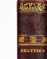
Unknown - Souvenir : Plan du Champ de Bataille de Waterloo - 1900


Starting bid
€ 1
Add to your favourites to get an alert when the auction starts.

Catawiki Buyer Protection
Your payment’s safe with us until you receive your object.View details
Trustpilot 4.4 | 138513 reviews
Rated Excellent on Trustpilot.
Description from the seller
A rare cartographic souvenir from the Belle Époque: Waterloo's strategy enclosed in its original early-20th-century binding, published in the prelude to the first centenary. Rare.
PHYSICAL DESCRIPTION:
1 large color fold-out topographic map (open about 47 cm x 41 cm), explanatory notes in French and English on a folded sheet. Variant in contemporaneous hardcover (Hardcover Deluxe variant).
The map is mounted on the back flyleaf to allow it to open in a concertina without risking tearing.
COMMENT
First edition.
The map shows with great graphical accuracy the colored blocks of Napoleon's and Wellington's armies positioned on the field on 18 June 1815.
The publication is a bilingual (French/English) retrospective historical cartography study designed for educational purposes. It freezes 18 June 1815 at the crucial moment of the clash and the strategic positions of Napoleon's and Wellington's armies. This rigid pamphlet was an elite souvenir purchased on the battlefield.
The volume is born at the beginning of the 20th century in conjunction with three precise historical factors:
Memory Tourism (the inauguration of the direct tram line Brussels-Waterloo in 1901 opens the site to the middle class), the approach of the Centenary (In the 1900-1910 decade Belgian publishing intensifies prints to prepare for the great celebrations of the battle's centennial (1815-1915)), and the Entente Cordiale (1904): With the historic peace between France and Great Britain, Waterloo ceases to be the symbol of a partisan victory and becomes a site of European shared memory.
Notes on rarity: Very rare. If the flexible green-paper editions were easily damaged during travel, this rigid variant has allowed the copy to remain in excellent condition, making it a highly sought-after military cartographic collectible.
A rare cartographic souvenir from the Belle Époque: Waterloo's strategy enclosed in its original early-20th-century binding, published in the prelude to the first centenary. Rare.
PHYSICAL DESCRIPTION:
1 large color fold-out topographic map (open about 47 cm x 41 cm), explanatory notes in French and English on a folded sheet. Variant in contemporaneous hardcover (Hardcover Deluxe variant).
The map is mounted on the back flyleaf to allow it to open in a concertina without risking tearing.
COMMENT
First edition.
The map shows with great graphical accuracy the colored blocks of Napoleon's and Wellington's armies positioned on the field on 18 June 1815.
The publication is a bilingual (French/English) retrospective historical cartography study designed for educational purposes. It freezes 18 June 1815 at the crucial moment of the clash and the strategic positions of Napoleon's and Wellington's armies. This rigid pamphlet was an elite souvenir purchased on the battlefield.
The volume is born at the beginning of the 20th century in conjunction with three precise historical factors:
Memory Tourism (the inauguration of the direct tram line Brussels-Waterloo in 1901 opens the site to the middle class), the approach of the Centenary (In the 1900-1910 decade Belgian publishing intensifies prints to prepare for the great celebrations of the battle's centennial (1815-1915)), and the Entente Cordiale (1904): With the historic peace between France and Great Britain, Waterloo ceases to be the symbol of a partisan victory and becomes a site of European shared memory.
Notes on rarity: Very rare. If the flexible green-paper editions were easily damaged during travel, this rigid variant has allowed the copy to remain in excellent condition, making it a highly sought-after military cartographic collectible.
Details
Number of books
1
Subject
Military, Original artwork, War history
Book title
Souvenir : Plan du Champ de Bataille de Waterloo
Author/ Illustrator
Unknown
Condition
Fair
Publication year oldest item
1900
Height
17 cm
Edition
1st Edition Thus
Width
12.5 cm
Language
English, French
Original language
Yes
Publisher
[s.l.; s.n., s.d., stampato circa nel 1900 / 1910] (Probabilmente impresso a Bruxelles o Waterloo).
Binding/ Material
Hardback
Number of pages
4