M. Adolphe Thiers / Th. Duvotenay & Ch. Dyonnet - Atlas des campagnes de la Révolution française - 1890


06
days
15
hours
31
minutes
07
seconds

 | €2 |
|---|
Catawiki Buyer Protection
Your payment’s safe with us until you receive your object.View details
Trustpilot 4.4 | 145414 reviews
Rated Excellent on Trustpilot.
Description from the seller
Fascinating illustrated edition featuring 32 double-page geographical maps mounted on tabs, offering a major visual and analytical tool for understanding the military and geopolitical events of the French Revolution -
The work presents a series of detailed maps tracing the campaigns, battles and movements of the French and foreign armies, highlighting strategies, points of engagement and the consequences of conflicts across France and Europe -
It combines topographical precision with historical rigor, providing clear legends, chronological markers and explanatory annotations to facilitate the analysis of military operations and understanding of tactical and strategic issues -
The Atlas also illustrates the evolution of borders, garrison positions and lines of communication, making it possible to grasp the dynamics of war and its political and social repercussions -
M. Adolphe Thiers / Th. Duvotenay & Ch. Dyonnet - Atlas of the Campaigns of the French Revolution - n.d. (circa 1890) - Furne, Jouvet et Cie -
32 maps
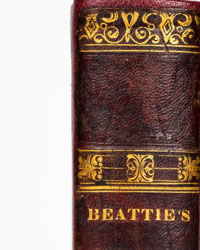
Binding in fair condition; the book is in its original half-leather binding, with signs of wear, a few minor defects to the cover, a damaged spine with material missing at the tail, split hinges, one missing endcap, worn corners, speckled edges, a plain smooth spine, and a titled front cover -
Interior in good condition, with a few marks, a beautiful vignette on the title page; the work is enhanced with 32 double-page geographical maps mounted on tabs, drawn by Th. Duvotenay and engraved by Ch. Dyonnet; endpapers in fair condition; a good copy -
Shipping arranged within a few days –
Details
Number of books
1
Subject
Cartography, Geography, History, Illustrated, Politics, Reference, War history
Book title
Atlas des campagnes de la Révolution française
Author/ Illustrator
M. Adolphe Thiers / Th. Duvotenay & Ch. Dyonnet
Condition
Good
Publication year oldest item
1890
Edition
Illustrated Edition
Language
French
Original language
Yes
Publisher
Furne, Jouvet et Cie
Binding/ Material
Half leather
Number of pages
32