Asia - Middle East / Asia Minor / Turkey / Armenia / Iran; Adrien Brue - Carte de l'Empire d'Alexandre..... 1822 - 1801-1820
Asia - Middle East / Israel / Palestine / Asia Minor / Holy Land / Jerusalem; Christopher Weigel & David Kohler - Iudaea Capta - 1701-1720
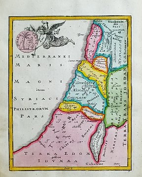
Asia - Turkey / Armenia / Cyprus / Asia Minor / Middle East; Desmarest & Bonne - Mappa Dispersus Filiorum Noemi - 1781-1800
Europe - European countries in the 15th century.; Gerard Mercator - Gerardi Mercatoris Atlas Europae 1579 - 1561-1580
Globe / World Map - [Lot of 2] - World Map in Hemispheres; Desmarest & Bonne - Mappe-Monde sur le Plan de l'Equateur: Hemisphere Septentrional & Hemisphere Meridional - [LOT of 2] - 1781-1800
India - Mappa, the Malay archipelago, the Philippines, and parts of northern Australia and New Guinea.; Santini, Paolo /, Bonne, Rigobert / Janvier, Jean / Rizzi - doppia filigrana "Archipel des Indes Orientales" - 1761-1780
Indonesia - Jakarta, Batavia, Java; J. van Schley / N. Bellin - Batavia assiegé en 1629 / Batavia a. 1629 belegerd - 1747
Indonesia - Java, Jakarta (Batavia), Ciliwung, Veteran Street / Ir. H. Juanda Street / State Palace; Jacob Van der Schley - Vue du Fort Noortwyck../Gezigt van ´T Fort Noordwyck. - 1751-1760
Edo Kiri-ezu – Kohinata District Map – Kaei 5 (1852), Owariya Seishichi Publisher - Japan - Edo Period (1600-1868)
Greece - Island of Crete; Cosmographia Universalis, Sebastian Munster, 1556 - Mappa di Creta del XVI secolo - 1551-1560
Japan - Japan; Drawn by Kiminaga Kunitoshi & Kimura Kunimitsu - “Harima Akashi – Hitomaruyama / Kakimoto Shrine Illustrated Map” - Meiji 28 (1895)
Japan - Japan; 東京印刷株式会社 - “Manchukuo and China Large Map with Shanghai City Map – Commemorative Edition for the 1932 Shanghai - 1932
Asia - Japan / Nagasaki / VOC handelspost Deshima; J.N. Bellin - Plan de la Ville et du Port de Nangasaki - 1751-1760
United Kingdom - U.K., Ireland, England, Wales, Scotland, North Sea, English Channel, Irish Sea....; John Harris, John Senex & Henry Wilson. - A Globular Chart Shewing the errors of Plain, and the Deficiencyes of Mercators Sailing, and - 1721-1750
World - South America / South Africa / South America / Chile / Patagonia; La Haye / P. de Hondt / J.N. Bellin - Carte de l'Ocean Meridional - 1721-1750
Asia - East Indies / Philippines / Borneo / Sumatra / Taiwan / New Guinea; Desmarest & Bonne - La Presqu'Isle de l'Inde, au de la du Gange, avec l'Archipel des Indes (Partie Orientale) - 1781-1800
Asia - China/Korea/Japan/Philippines/Vietnam; Rigobert Bonne/ Claude-Marie-François Dien - Carte de L'Empire de la Chine, de la Tartarie Chinoise et du Royaume de Corée: avec les Isles du - 1801-1820