No. 102397890

No. 102397890
Bonne édition enrichi de 37 cartes coloriées et gravées sur cuivre offrant une représentation complète et méthodique du monde à travers des cartes précises et richement détaillées destinées à un usage à la fois éducatif et scientifique -
L’ouvrage présente des cartes couvrant les continents, les États, les mers et les principales régions du globe, mettant en évidence les reliefs, les réseaux hydrographiques, les frontières politiques et les grandes villes, tout en intégrant des données actualisées sur les divisions territoriales et les zones d’influence -
Les cartes sont accompagnées de légendes claires, d’échelles rigoureuses et d’indications toponymiques permettant une lecture précise et comparative des espaces, facilitant ainsi la compréhension des relations géographiques et géopolitiques -
L’atlas reflète également les avancées cartographiques de son époque, notamment dans la précision des tracés, la normalisation des symboles et l’attention portée aux détails topographiques et politiques -
Conçu pour les étudiants, les enseignants et les amateurs de géographie, il favorise le développement de la mémoire spatiale, de l’esprit d’analyse et de la culture générale, tout en constituant un outil de référence pour la connaissance du monde à la fin du XIXᵉ siècle -
SN - Atlas-général - 1891 - Gotha -
37 cartes coloriées
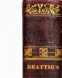
Bon état de la reliure, ouvrage dans sa demi toile rouge à coins d'édition, frottements d’usage, mors avant fendillé, infimes défauts sur plats et dos, coiffes et coins usés, tranches jaspées, dos lisse muet, premier plat titré en lettres d'or -
Bon état intérieur, brunissures, ouvrage enrichi de 37 cartes coloriées et gravées sur cuivre, pages de garde en état correct -
Service de livraison assuré sous quelques jours –
How to buy on Catawiki
1. Discover something special
2. Place the top bid
3. Make a secure payment