Cabo Verde - Island of Fogo; Charles Sainte-Claire Deville (1814-1876) - Esquisse topographique de l’île de Fogo, 1846 - 1821-1850
Europe - France / Bretagne / Brittany / Quimper / Concarneau ....; J.N. Bellin / Dépôt des cartes et plans de la Marine - 6.me Carte Particuliere des Costes de Bretagne depuis la Baye d' Hodierne jusqu' a l' Isle de Groa, - 1751-1760
Europe - Greece / North-East Europe / Balkans / Crete / Bulgaria / Romania / Kosovo / Serbia; Christopher Weigel & David Kohler - Graeciae et Archipelagis >Delineatio - 1701-1720
Europe - North-East Europe / Balkans / Greece / Bulgaria / Romania / Kosovo; A. Grenet / R. Bonne - Mappa Greciae Antiquae et Vicinarum Regionum - 1761-1780
South Pacific - Western Indian Ocean / Maldives; Published at the Admiralty 30th April 1906 - Malediven und Fadiffolu Atoll - 1901-1920
Türkiye - Smyrna (Izmir); Cornelis de Bruyn - Untitled- in later editions: "Vue de Smyrna et du Port" (View of Smyrna and the Port) - 1681-1700
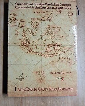
Wereld - Atlas of the VOC; Atlas Major - Grote atlas van de Verenigde Oost-Indische Compagnie deel I / Comprehensive Atlas of the Dutch - Entire VOC period
Wereld - Indian Archipelago and Oceania; Atlas Major - Grote atlas van de Verenigde Oost-Indische Compagnie deel III / Comprehensive Atlas of the Dutch - VOC period
World - Worldwide Seas and Oceans; Agnese, Waghenaer, Blaeu, Van Keulen, Vingboons, a.m.o. - Die Vermessung der Meere. Historische Seekarten + Historische Seekarten - 1000-1900
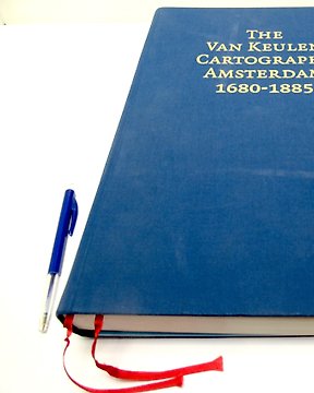
World - Worldwide Seas, Oceans, Islands; Van Keulen Family - The Van Keulen Cartography Amsterdam 1680-1885 - 1680-1885
World - esp. histororical China; Ptolemy, Hessel Gerritz, Joan Martines, Ludovico Georgio, a.m.o. - China Cartographica + Das Buch der Karten - 1000 bc - 2000 ac
Asia - Russia, China, North Korea, South Korea, Taiwan, Jesuit Land (fictitious)....; P.F.X. De Charlevoix / Dheulan / Bellin - Carte des Isles du Japon Et des Costes de la Chine les plus voisines Avec les Terres qui en sont au - 1721-1750
Japan - Osaka; P.F.X. De Charlevoix / Dheulland - Carte de l'empire du Japon, dressée sur les auteurs japonois, .... - 1721-1750
France - World; Commandant P. Pollacchi (cartes et texte) - Atlas Colonial Français – Colonies, Protectorats et Pays sous Mandat L’Illustration – 1938 3ᵉ - 1921-1950
Impero del Giappone - Map OCHIO, QUANTO, JETSEGEN, JETSEN, JAMAISOIT, XICOCO, and XIMO; Santini, Paolo /, Bonne, Rigobert / Janvier, Jean / Rizzi - doppia filigrana "L'Empire du Japon" - 1761-1780
Türkiye - Klein Asia in the 18th century.; Bonne/Desmarest - Turquie d'Asie a l'exdception des enclaves situées en Arabie. - 1781-1800
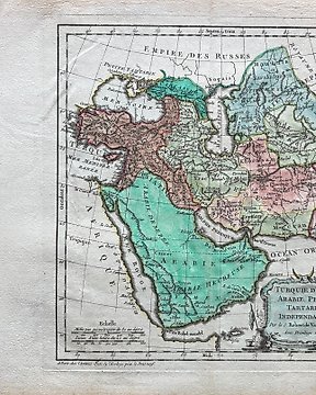
Türkiye - Türkiye; Robert de Vaugondy/ gravé par F. Dussy - Turquie d'Asie, Arabie, Perse, Tartarie Indépendante - 1761-1780
Wereld; Europa; Azie; Afrika Rusland; Italie; Engeland; Frankrijk; Spanje; - World; Las Cases, Emmanuel Auguste Dieudonné Marius Joseph - 17 maps from the "Historisch-genealogisch-geographischer Atlas" by Las Cases - 1821-1850
World - Europe; Franz Hogenberg / Michael von. Aytzing - Der älteste Reiseatlas der Welt / Itinerarium Orbis Christiani - 1579-1589
Impero Cinese e della Tartaria Cinese - Mappa; Santini, Paolo /, Bonne, Rigobert / Janvier, Jean / Rizzi - doppia filigrana "L'Empire de la Chine, Avec la Tartarie Chinoise" - 1761-1780